


Good Monday night!
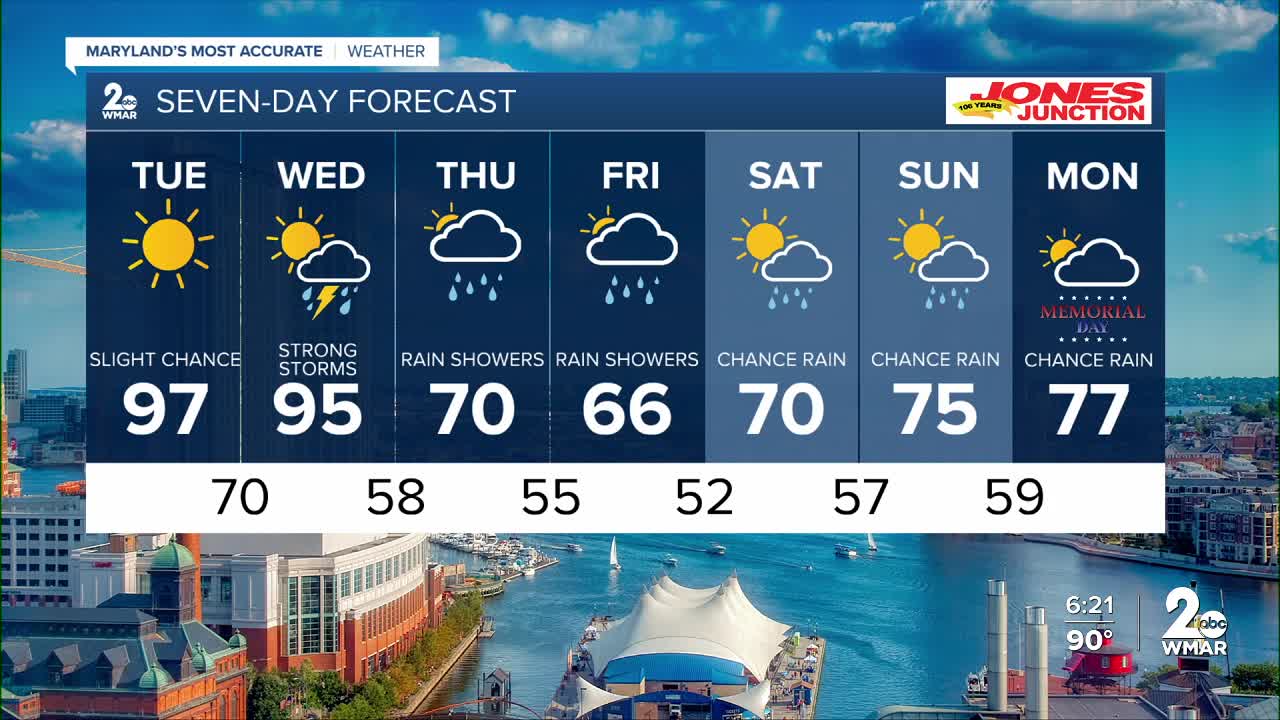
A major warm-up is underway across the Mid-Atlantic, and the hottest temperatures of the season so far are expected through Tuesday. Afternoon highs will climb well into the 90s, with a few spots potentially nearing the upper 90s Tuesday afternoon. The heat will feel even more intense as humidity gradually increases through midweek.
While most areas stay dry, isolated thunderstorms are possible each afternoon and evening near the mountains.
The more significant weather arrives Wednesday as a strong cold front sweeps through the region. Widespread showers and thunderstorms are expected during the afternoon and evening hours, and some storms could become severe depending on how much instability develops ahead of the front.
Behind the front, a dramatic cooldown arrives for the end of the week. Temperatures will tumble from the 90s into the upper 60s and lower 70s by Thursday, bringing a much different feel to the air. Cooler, unsettled conditions with lingering showers may continue into Friday before temperatures begin to rebound heading into next weekend.
Dylan

Tuesday Mostly sunny, with a high near 97.
Tuesday Night Partly cloudy, with a low around 73.
Wednesday Showers and possibly a thunderstorm after 2pm. High near 95.
Wednesday Night Showers and possibly a thunderstorm before 8pm, then showers likely. Low around 58.
Thursday A chance of showers. Mostly cloudy, with a high near 70.
Thursday Night A chance of showers. Mostly cloudy, with a low around 53.
Friday Showers likely, mainly after 2pm. Mostly cloudy, with a high near 68.
Friday Night Showers likely. Mostly cloudy, with a low around 54.
Saturday A chance of showers. Mostly cloudy, with a high near 73.
Saturday Night Showers likely. Mostly cloudy, with a low around 59.
Sunday A chance of showers. Mostly cloudy, with a high near 78.

