



Good Sunday night!
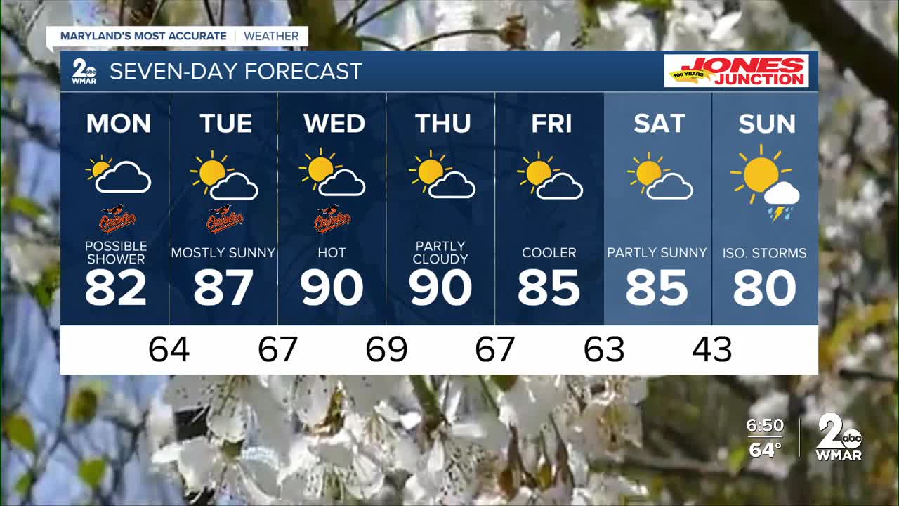
After a sunny weekend, clouds will increase overnight as a front moves through the region. Forecast models suggest a few showers may develop Monday, but much of that rain may evaporate before reaching the ground due to very dry air near the surface.
Winds will ramp up Monday as the front passes, with occasional gusts over 40 mph.
There is also an elevated wildfire risk Monday. Vegetation has dried out from the lack of recent rainfall, and the combination of gusty winds and low humidity will make conditions more favorable for fire spread. It’s best to avoid any outdoor burning.
A major warmup is expected by midweek as high pressure builds in. I’m expecting Maryland to hit 90° for the first time since September 6, 2025—that’s a stretch of 218 days!
Stay cool,
Dylan

Monday
Partly sunny, with a high near 82. Southwest wind 10 to 14 mph, with gusts as high as 25 mph.
Monday Night
Partly cloudy, with a low around 62. West wind around 6 mph becoming calm in the evening.
Tuesday
Mostly sunny, with a high near 87. Calm wind becoming southwest 5 to 9 mph in the afternoon.
Tuesday Night
Partly cloudy, with a low around 65. Southwest wind around 5 mph becoming calm in the evening.
Wednesday
Mostly sunny, with a high near 89.
Wednesday Night
Mostly cloudy, with a low around 66.
Thursday
Partly sunny, with a high near 89.
Thursday Night
Mostly cloudy, with a low around 67.
Friday
Mostly sunny, with a high near 85.
Friday Night
Mostly clear, with a low around 62.
Saturday
Mostly sunny, with a high near 87.
Saturday Night
Mostly cloudy, with a low around 64.
Sunday
A chance of showers. Partly sunny, with a high near 83. Chance of precipitation is 30%.

