


Good Sunday evening!
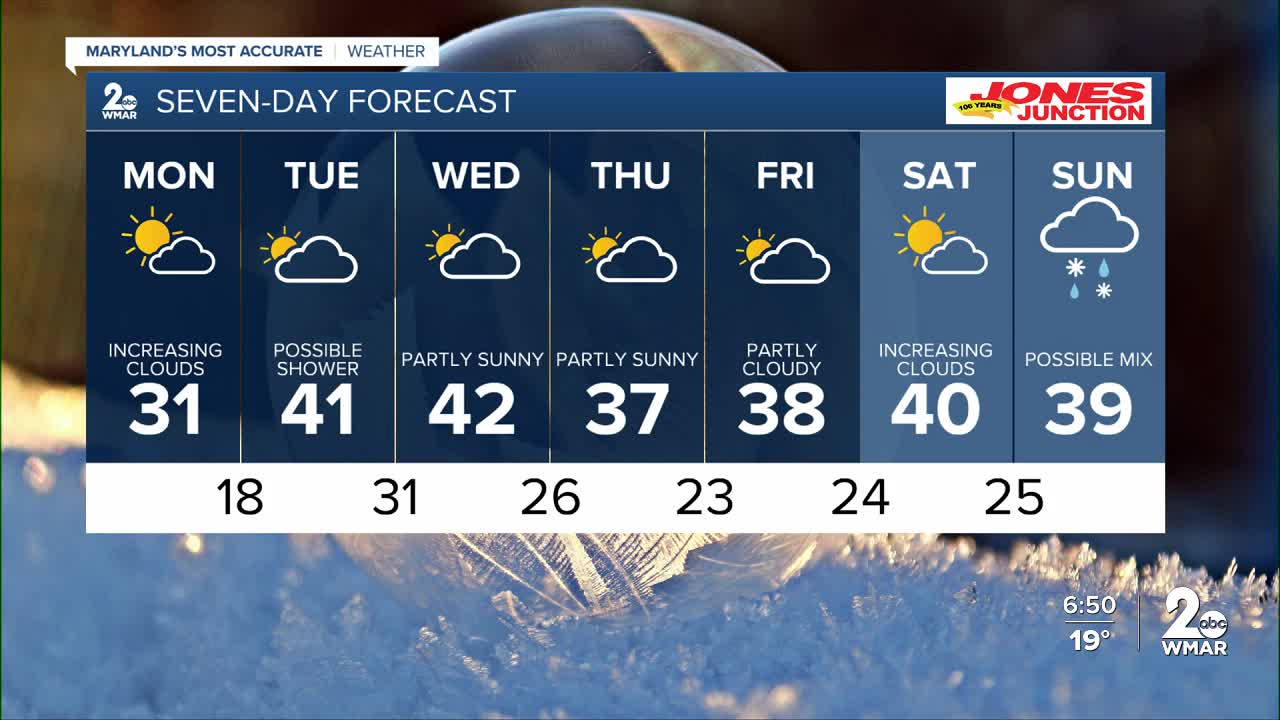
It looks like we’re officially past the coldest stretch of winter. Both short- and long-range models are pointing toward more seasonable temperatures heading forward. Sunshine kicks off the day Monday, with clouds gradually increasing through the afternoon. It’ll also be milder and less windy.
A weak system moves through on Tuesday, though most—if not all—of the moisture stays to our north. We should remain dry overall, but a brief sprinkle can’t be ruled out. The rest of the week stays dry, with increased cloud cover at times.
Models are hinting at a potential storm late next weekend, but confidence is low right now. We’ll continue to fine-tune the forecast and keep you updated throughout the week!
Dylan
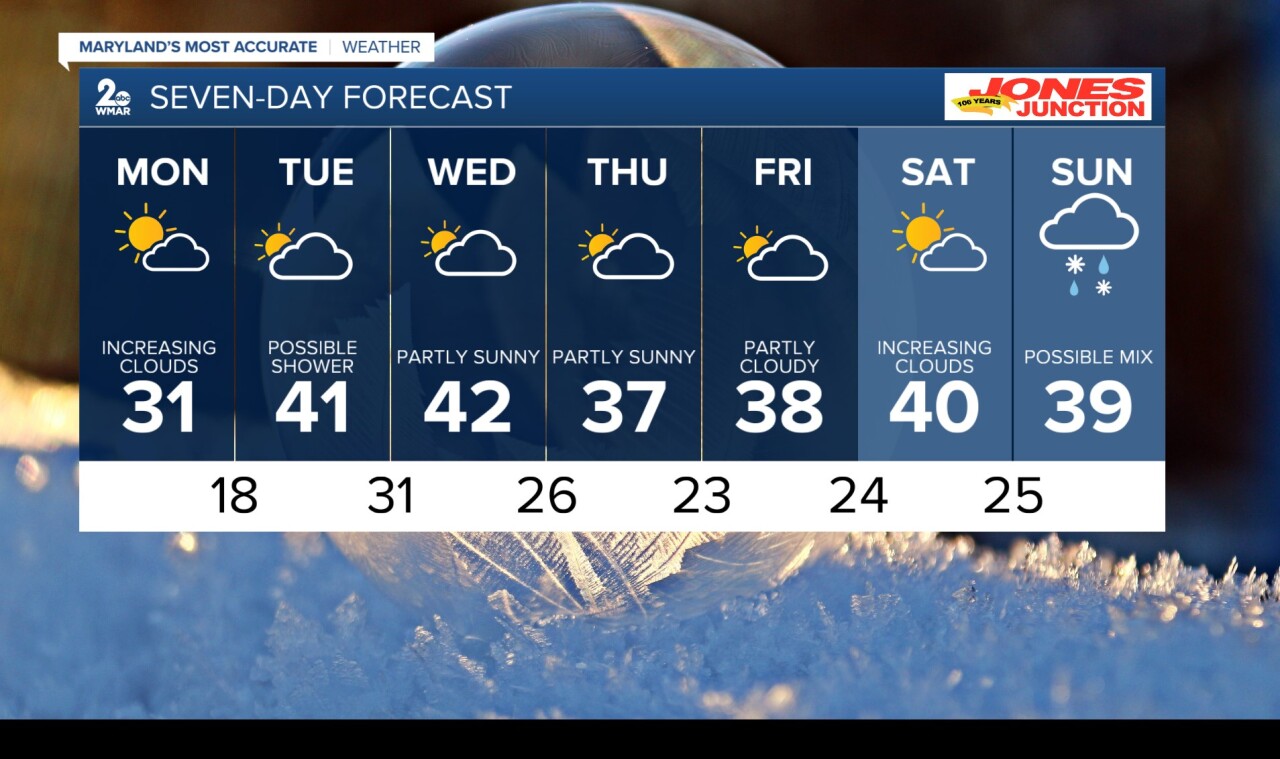
Monday
Sunny, with a high near 32. Northwest wind 3 to 6 mph.
Monday Night
Mostly cloudy, with a low around 18. Calm wind.
Tuesday
Partly sunny, with a high near 41. Calm wind becoming south around 6 mph in the afternoon.
Tuesday Night
Partly cloudy, with a low around 30. Light and variable wind becoming northwest around 6 mph in the evening.
Wednesday
Partly sunny, with a high near 42.
Thursday
Partly sunny, with a high near 37.
Friday
Mostly sunny, with a high near 37.
Saturday
Mostly sunny, with a high near 40.
Sunday
A chance of rain. Partly sunny, with a high near 42. Chance of precipitation is 40%.

