

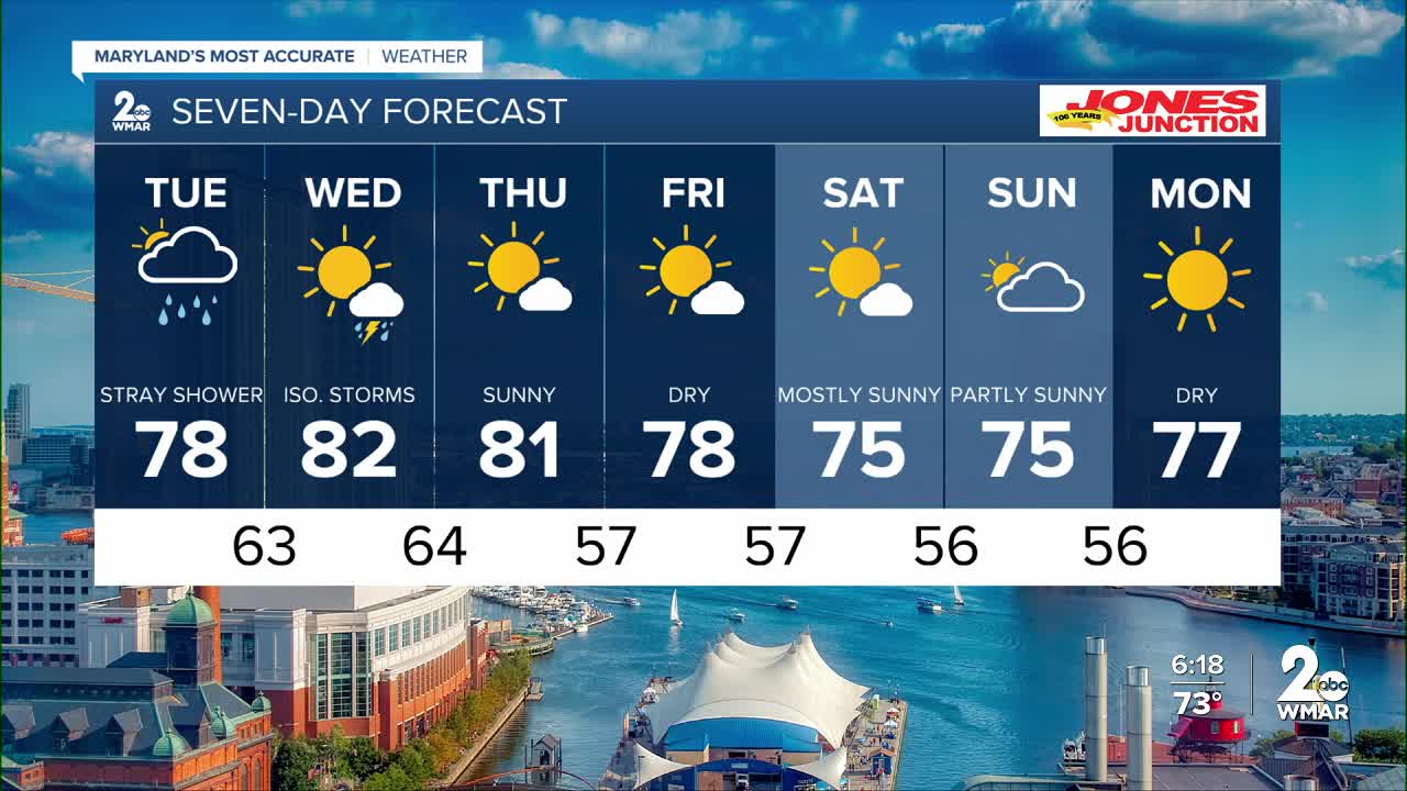


Tuesday starts with areas of low clouds and fog, which could drop visibility down to one to three miles between 3 AM and 8 AM. While some breaks of sun are possible for northern areas, cloudy skies will generally prevail with highs reaching the mid to upper 70s. Scattered showers and a few thunderstorms are most likely to develop Tuesday afternoon, primarily for communities south of Baltimore City.
Drier air begins to push in on Thursday as high pressure builds over the region. This will clear the clouds and drop humidity levels significantly. Afternoon temperatures will hover around 80 degrees on Thursday before settling into the 70s for Friday and the upcoming weekend.
Dylan

Tuesday A chance of showers, mainly before 1pm. Mostly cloudy, with a high near 79.
Tuesday Night A slight chance of showers after 2am. Mostly cloudy, with a low around 65.
Wednesday A chance of showers, with thunderstorms also possible after 2pm. Mostly cloudy, with a high near 82.
Wednesday Night Mostly cloudy, with a low around 64.
Thursday Sunny, with a high near 82.
Thursday Night Mostly clear, with a low around 62.
Friday Sunny, with a high near 80.
Friday Night Partly cloudy, with a low around 57.
Saturday Mostly sunny, with a high near 77.
Saturday Night Partly cloudy, with a low around 56.
Sunday Partly sunny, with a high near 75.

