

BALTIMORE — Thursday starts with temperatures in the upper 40s and lower 50s. Afternoon highs will struggle to reach the 60s as cooler air settles in behind a cold front. While most rain moves south by Thursday morning, a stray shower remains possible under mostly cloudy skies before clearing begins later in the day. While Friday remains dry with highs near 70 degrees, rain chances increase Saturday and Sunday as another cold front moves through the area.

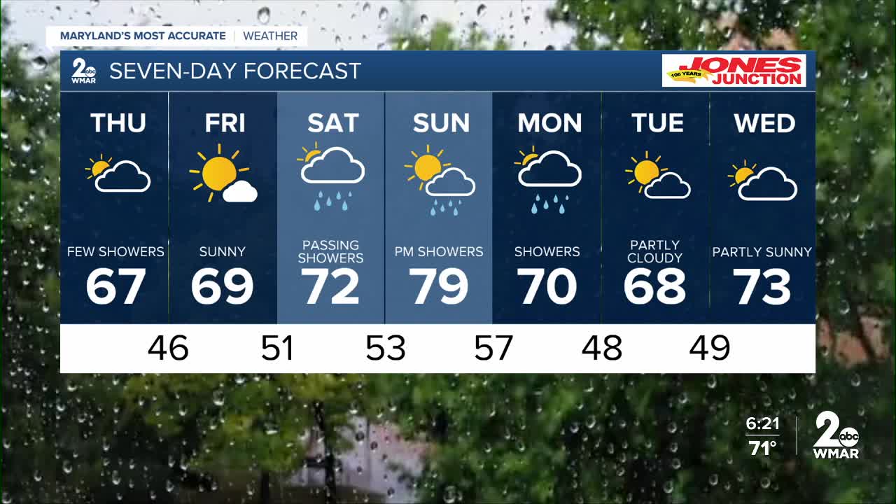
7 Day Forecast:
Thursday Showers likely. Mostly cloudy, with a high near 64.
Thursday Night A chance of showers. Partly cloudy, with a low around 46.
Friday Sunny, with a high near 68.
Friday Night Partly cloudy, with a low around 51.
Saturday A chance of showers. Partly sunny, with a high near 72.
Saturday Night Partly cloudy, with a low around 53.
Sunday Mostly sunny, with a high near 79.
Sunday Night A chance of showers. Mostly cloudy, with a low around 57.
Monday Showers likely. Mostly cloudy, with a high near 70.
Monday Night A chance of showers. Mostly cloudy, with a low around 48.
Tuesday Partly cloudy, with a high near 71.
Tuesday Night A chance of showers. Partly cloudy, with a low around 49.
Wednesday A chance of showers. Partly sunny, with a high near 73.

