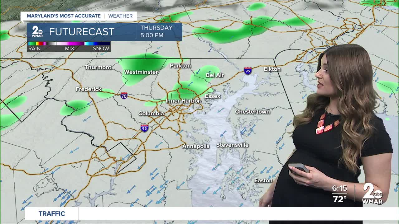


A cold front will bring strong to severe thunderstorms to the area this afternoon and evening. The severe weather window will be between 3-9 PM with wind, hail, and downpours being the biggest concern. The Storm Prediction Center has placed the area under a Marginal Risk (level 1/5). The flood risk is low as this rain will largely be beneficial given the ongoing severe drought. The tornado threat is low as well.
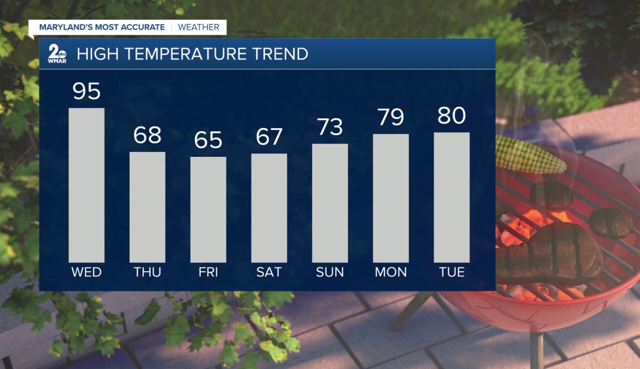
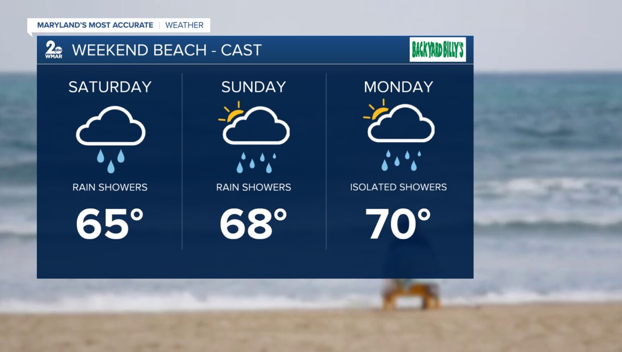
In addition to the rain and storms, the cold front will finally bring some relief from the intense heat and higher humidity after today! Temperatures will only rise into the 60s later this week and for the first half of the holiday weekend. If you're heading down to the ocean this weekend make sure you pack the rain jacket as off and on rain showers will be featured each day.
#StevieDanielsWX
Email: stevie.daniels@wmar.com
Facebook: www.facebook.com/StevieDanielsWX
X: www.twitter.com/StevieDanielsWX
Instagram & TikTok: stevie_daniels_

