

BALTIMORE — Happy Thursday! Mostly dry today with plenty of sunshine and seasonal temperatures, in the mid to upper-80s. Showers and thunderstorms are expected to develop tonight, but most of the storm activity stays out toward the mountains. A cold front will slowly sag southward on Friday and Saturday, increasing the threat of showers and thunderstorms both days. Some storms on Friday could produce gusty winds along with heavy downpours. Scattered periods of heavy rain are possible on Saturday. Conditions begin to dry out on Sunday with a decent amount of humidity. Next week, temperatures will soar into the low to mid-90s!
Have a sunny day!

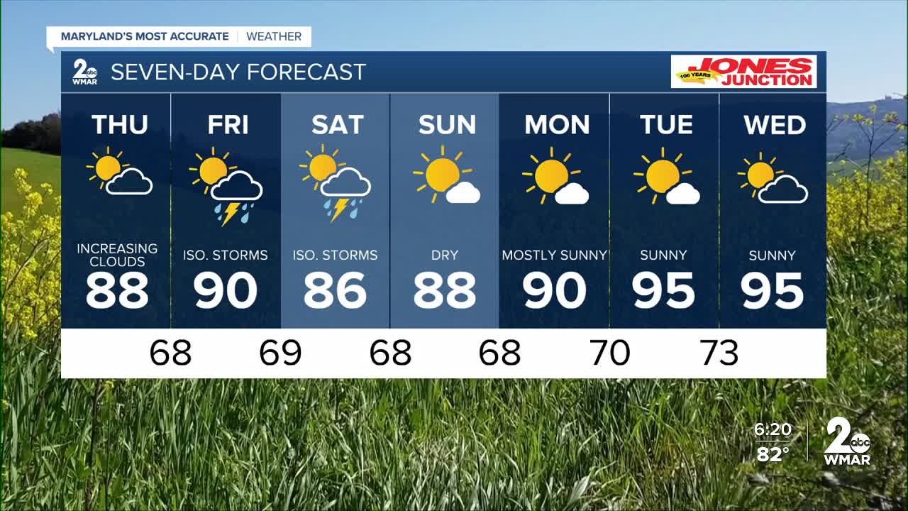
7 Day Forecast:
Thursday Mostly sunny, with a high near 88. Light southwest wind becoming south 5-15 mph in the morning.
Thursday Night Increasing clouds, with a low around 68. South wind 5-15 mph becoming light after midnight.
Friday A chance of showers and thunderstorms. Partly sunny, with a high near 90.
Friday Night A chance of showers and thunderstorms. Low around 68.
Saturday Showers likely, then showers and possibly a thunderstorm. High near 85.
Saturday Night Showers and possibly a thunderstorm. Low around 67.
Sunday Mostly sunny, with a high near 87.
Sunday Night Partly cloudy, with a low around 68.
Monday Mostly sunny, with a high near 90.
Monday Night Partly cloudy, with a low around 69.
Tuesday Mostly sunny, with a high near 95.
Tuesday Night Mostly clear, with a low around 73.
Wednesday Partly cloudy, with a high near 96.

