

BALTIMORE — Good Tuesday night!
The summer sizzler is coming to an end soon, but first we have one more day of extreme heat to get through. Highs will climb into the mid 90s Wednesday before a strong cold front moves through during the afternoon and evening hours, bringing the chance for thunderstorms.
The front is expected to move through between 2 PM and 8 PM Wednesday. A few storms could become strong, with damaging wind gusts and small hail as the primary threats.
An Air Quality Alert remains in effect through Wednesday as elevated ozone levels may reduce air quality. Those with respiratory issues may want to limit time outdoors if possible.
A much cooler and unsettled pattern settles in Thursday through Sunday, bringing daily rain chances and a noticeable break from the heat. Conditions trend warmer and somewhat drier by Memorial Day, though we can’t completely rule out a stray shower.
Dylan

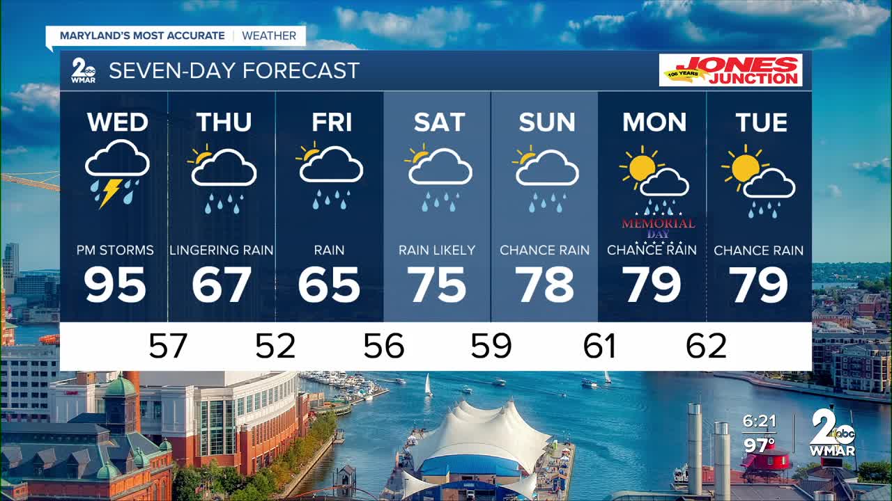
7 Day Forecast:
Tonight Partly cloudy, with a low around 73. South wind around 5-10 mph.
Wednesday Showers and possibly a thunderstorm. High near 95.
Wednesday Night Showers and possibly a thunderstorms. Low around 58.
Thursday Showers likely. Mostly cloudy, with a high near 70.
Thursday Night A chance of showers. Mostly cloudy, with a low around 53.
Friday Showers likely. Mostly cloudy, with a high near 66.
Friday Night Showers. Low around 52.
Saturday Showers. High near 70.
Saturday Night Showers likely. Mostly cloudy, with a low around 57.
Sunday Showers likely. Mostly cloudy, with a high near 76.
Sunday Night Showers likely. Mostly cloudy, with a low around 59.
Memorial Day A chance of showers. Mostly cloudy, with a high near 77.
Monday Night A chance of showers. Mostly cloudy, with a low around 61.
Tuesday A chance of showers. Mostly cloudy, with a high near 78.

