


Good morning, happy Thursday.
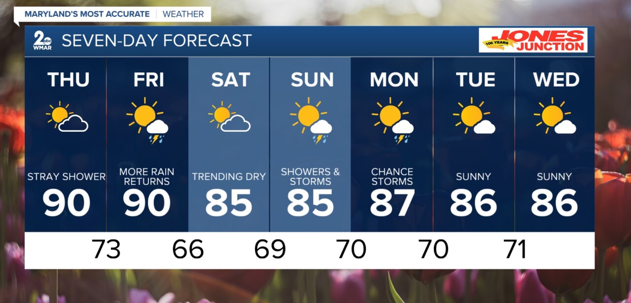
Overall, looking like a nice, but hot day ahead. Sunshine should take over, giving us warmer temperatures and drier skies. The 90s are possible this afternoon. Great news with the latest drought monitor- we are seeing HUGE improvement for the eastern tier of the state. Rain returns as soon as Friday, with storms possible. Cooler temperatures settle in following Thursday with the 80s for highs. Off and on shower chances follow us into next week.
Overnight
Mostly cloudy, with a low around 71.
Thursday
Mostly sunny, with a high near 90.
Thursday Night
Mostly cloudy, with a low around 73.
Friday
A slight chance of showers and thunderstorms after 2pm. Partly sunny, with a high near 85.
Friday Night
A slight chance of showers and thunderstorms, then a chance of showers after 8pm. Mostly cloudy, with a low around 66.
Saturday
Mostly sunny, with a high near 85.
Saturday Night
Mostly cloudy, with a low around 69.
Sunday
A chance of showers and thunderstorms, mainly after 2pm. Partly sunny, with a high near 86.
Sunday Night
A chance of showers and thunderstorms before 2am, then a slight chance of showers. Mostly cloudy, with a low around 70.
Monday
A slight chance of showers before 8am, then a chance of showers and thunderstorms after 2pm. Partly sunny, with a high near 88.
Monday Night
A chance of showers and thunderstorms. Mostly cloudy, with a low around 70.
Tuesday
Mostly sunny, with a high near 86.
Tuesday Night
Mostly clear, with a low around 71.
Wednesday
Sunny, with a high near 88.

