



Good Sunday night!
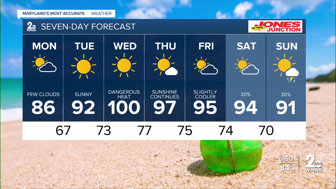
Our stretch of rain and thunderstorms has come to an end and will be replaced by a prolonged period of hot, dry weather. Strong high pressure begins building in on Monday, bringing plenty of sunshine through at least Saturday.
As this heat dome strengthens, temperatures will climb into the triple digits by Wednesday. The hottest days will be Wednesday and Thursday, when dangerous heat will make outdoor activities more challenging.
If you plan to work or spend time outside, be sure to have a plan to stay cool, take frequent breaks, and stay hydrated during the extreme heat.
Dylan

Monday
Mostly sunny, with a high near 86. East wind 3 to 7 mph.
Monday Night
Mostly clear, with a low around 66. Light and variable wind.
Tuesday
Sunny, with a high near 91. Calm wind becoming southwest 5 to 7 mph in the afternoon.
Tuesday Night
Clear, with a low around 70. Southwest wind around 6 mph.
Wednesday
Sunny and hot, with a high near 99.
Wednesday Night
Mostly clear, with a low around 76.
Thursday
Mostly sunny, with a high near 94.
Thursday Night
Partly cloudy, with a low around 74.
Friday
A chance of showers and thunderstorms after 2pm. Mostly sunny, with a high near 93. Chance of precipitation is 30%.
Friday Night
A chance of showers and thunderstorms. Partly cloudy, with a low around 73. Chance of precipitation is 30%.
Saturday
A chance of showers and thunderstorms. Partly sunny, with a high near 92. Chance of precipitation is 30%.
Saturday Night
A chance of showers and thunderstorms. Mostly cloudy, with a low around 71. Chance of precipitation is 40%.
Sunday
A slight chance of showers and thunderstorms. Partly sunny, with a high near 87. Chance of precipitation is 20%.

