



Good Sunday night!
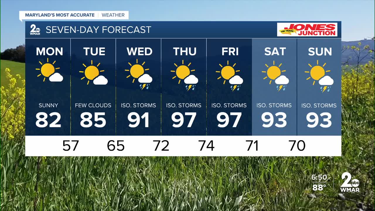
Cooler and drier air arrives in Baltimore on Monday. High pressure builds into the region on Monday following a cold front. Expect cooler and drier conditions throughout Monday with lower humidity. While temperatures will remain a few degrees above average, they will be noticeably more comfortable than the previous two days as the front pushes south. Heat and humidity build back into the area starting Wednesday as high pressure moves offshore. Thursday and Friday look to be the hottest days with temperatures climbing well into the 90s. Heat Index values may approach 100 degrees during this time alongside a returning risk for afternoon showers and thunderstorms.
Dylan

Monday
Sunny, with a high near 81. East wind around 8 mph.
Monday Night
Clear, with a low around 57. Southeast wind 5 to 10 mph becoming light after midnight.
Tuesday
Sunny, with a high near 84. Calm wind becoming south 5 to 9 mph in the afternoon.
Tuesday Night
Partly cloudy, with a low around 64. South wind 5 to 7 mph.
Wednesday
A slight chance of showers, then a chance of showers and thunderstorms after 2pm. Partly sunny, with a high near 91. Chance of precipitation is 40%.
Wednesday Night
A chance of showers and thunderstorms before 8pm. Mostly cloudy, with a low around 71. Chance of precipitation is 30%.
Thursday
Mostly sunny, with a high near 96.
Thursday Night
Partly cloudy, with a low around 72.
Friday
A chance of showers and thunderstorms after 2pm. Mostly sunny, with a high near 96. Chance of precipitation is 30%.
Friday Night
A chance of showers and thunderstorms. Mostly cloudy, with a low around 71. Chance of precipitation is 40%.
Saturday
A chance of showers and thunderstorms. Mostly sunny, with a high near 93. Chance of precipitation is 30%.
Saturday Night
A chance of showers and thunderstorms. Partly cloudy, with a low around 70. Chance of precipitation is 30%.
Sunday
A chance of showers. Mostly sunny, with a high near 93. Chance of precipitation is 30%.

