



BALTIMORE — Good Wednesday night!
High pressure will slide offshore on Thursday, allowing moisture to return to the region. While much of the day will remain dry, showers and thunderstorms are expected to develop late Thursday night, primarily across western Maryland. A stray shower may also drift into the Baltimore metro area late in the evening.
A cold front will slowly sag southward on Friday and Saturday, keeping the threat of showers and thunderstorms in the forecast. Some storms on Friday could produce wind gusts of 30 to 40 mph along with heavy downpours. Rain may linger into Saturday morning before drier weather returns for the second half of the weekend.
Once the front clears, attention turns to building heat. High pressure settles over the region Monday, sending temperatures into the mid- to upper 90s by Tuesday.
Dylan

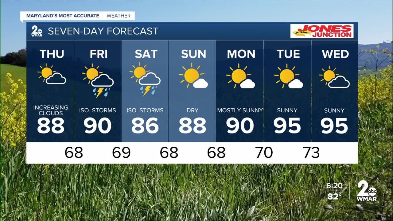
7 Day Forecast:
Thursday Sunny, with a high near 88.
Thursday Night Mostly cloudy, with a low around 68.
Friday Showers likely and possibly a thunderstorm. Partly sunny, with a high near 90.
Friday Night Showers and possibly a thunderstorm. Low around 69.
Saturday Showers likely and possibly a thunderstorm. Mostly cloudy, with a high near 86.
Saturday Night A chance of showers and thunderstorms. Mostly cloudy, with a low around 68.
Sunday Mostly sunny, with a high near 88.
Sunday Night Mostly clear, with a low around 68.
Monday Mostly sunny, with a high near 91.
Monday Night Partly cloudy, with a low around 69.
Tuesday A slight chance of showers. Mostly sunny, with a high near 94.
Tuesday Night Mostly clear, with a low around 71.
Wednesday Mostly sunny, with a high near 92.

