

BALTIMORE — Happy Monday! Severe storms possible today with highs in the low-90s! The timing for severe weather: 1 PM - 9 PM with the main threats being large hail, damaging wind gusts, localized flooding, and an isolated tornado or two. Conditions will trend drier and more seasonal on Tuesday and Wednesday. Isolated storm chances increase later this week and into the weekend.
Have a sunny day!

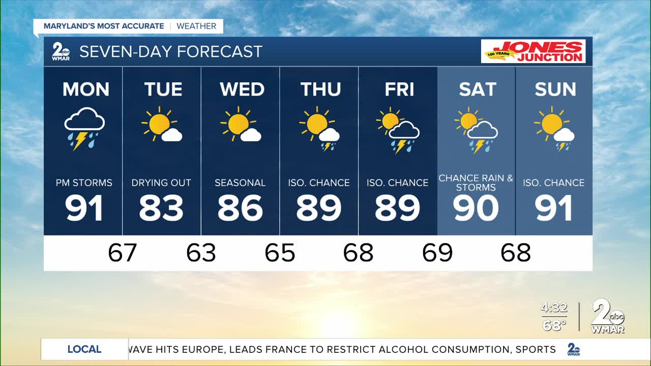
7 Day Forecast:
Today Showers and thunderstorms likely. High near 91. Southeast wind 5 to 15 mph becoming south in the afternoon. Winds could gust as high as 24 mph.
Tonight Showers and thunderstorms. Low around 67. South wind around 5 mph becoming calm in the evening.
Tuesday Mostly sunny, with a high near 83.
Tuesday Night Mostly clear, with a low around 63.
Wednesday Sunny, with a high near 86.
Wednesday Night Mostly clear, with a low around 65.
Thursday A chance of showers and thunderstorms. Mostly sunny, with a high near 89.
Thursday Night A chance of showers and thunderstorms. Mostly cloudy, with a low around 68.
Friday A chance of showers and thunderstorms. Partly sunny, with a high near 89.
Friday Night A chance of showers and thunderstorms. Mostly cloudy, with a low around 69.
Saturday A slight chance of showers and thunderstorms. Mostly sunny, with a high near 90.
Saturday Night A slight chance of showers and thunderstorms. Partly cloudy, with a low around 68.
Sunday A slight chance of showers and thunderstorms. Mostly sunny, with a high near 91.

