


Good morning and good Wednesday to you.
As light enters back in for the day we will see the full scope of the damage left from last night's system. Many people were impacted by the heavy rain and storms from Tuesday evening. Thankfully Wednesday's forecast is looking much calmer. Low pressure sits right on top of us as rain lingers off-shore. Temperatures rebound slightly this afternoon, with elevated winds from the north. Sunshine and drier skies will make Wednesday very comfortable. While rain is not looking likely today, off and on showers will linger into next week with seasonable temperatures.
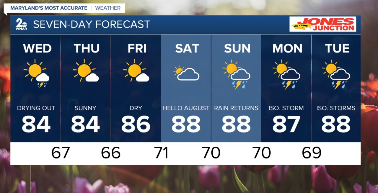
Wednesday
A chance of showers and thunderstorms after 2pm. Mostly sunny, with a high near 86.
Wednesday Night
A chance of showers and thunderstorms before 8pm. Partly cloudy, with a low around 67.
Thursday
Mostly sunny, with a high near 84.
Thursday Night
Partly cloudy, with a low around 69.
Friday
Sunny, with a high near 86.
Friday Night
Partly cloudy, with a low around 71.
Saturday
Partly sunny, with a high near 88.
Saturday Night
A slight chance of showers and thunderstorms. Mostly cloudy, with a low around 70.
Sunday
A chance of showers and thunderstorms. Partly sunny, with a high near 88.
Sunday Night
A chance of showers and thunderstorms. Mostly cloudy, with a low around 70.
Monday
A chance of showers and thunderstorms. Partly sunny, with a high near 89.

