

BALTIMORE — Good Wednesday night!
There are two major weather headlines we're tracking:
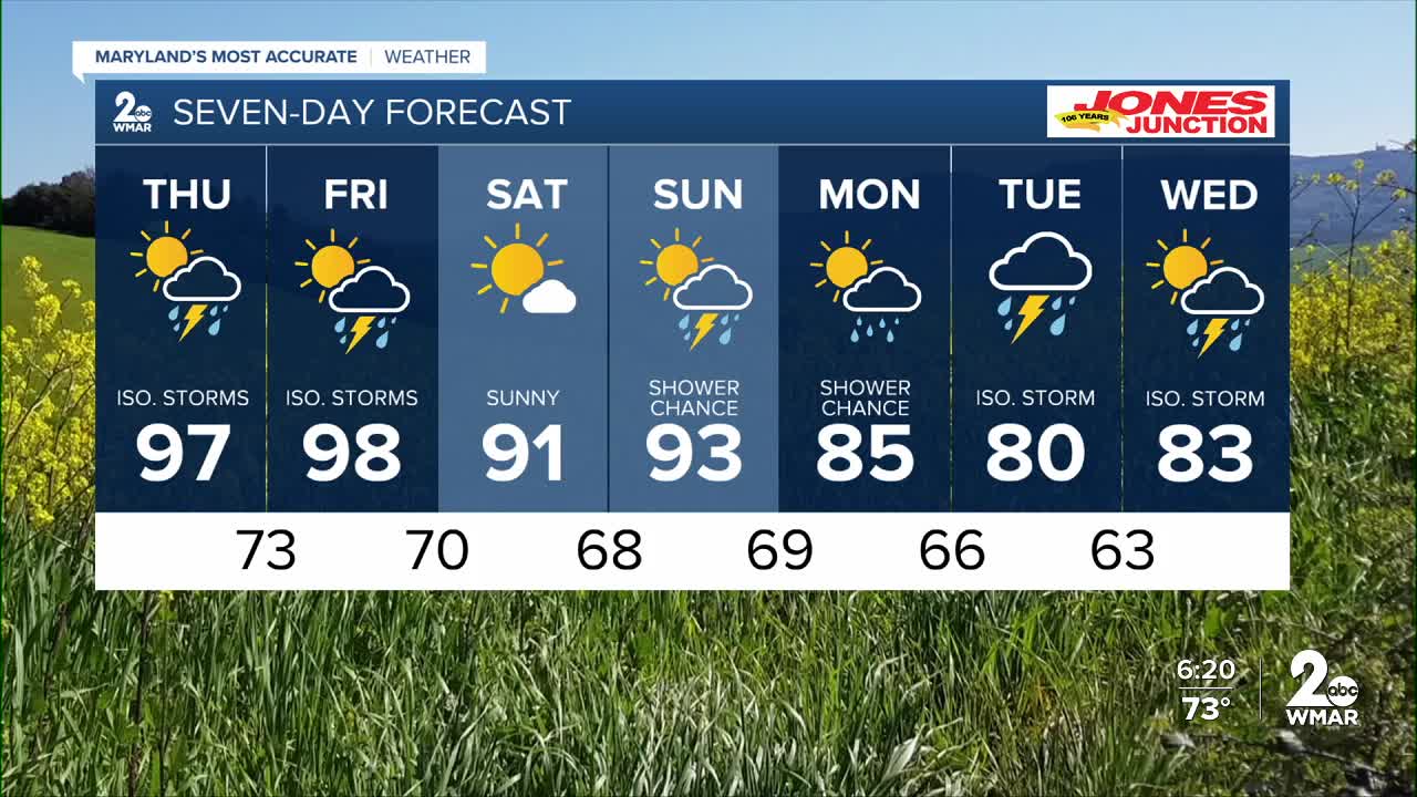
A. Extreme heat Thursday and Friday
B. Severe storms Thursday and Friday afternoon
High temperatures will surge into the mid and upper 90s Thursday and Friday, with a few locations approaching 100°. Combined with increasing humidity, it will feel more like 105° during the hottest part of the afternoon.
Temperatures will begin to ease Friday night and Saturday as a weak cold front pushes through the region.
In addition to the heat, two separate weather disturbances will bring the threat of severe thunderstorms Thursday and Friday afternoon. The primary window for storm development will be between 2 PM and 10 PM both days, with damaging wind gusts and large hail posing the greatest threats.
Be sure to stay weather-aware over the next couple of days, especially if you have outdoor plans.


7 Day Forecast:
Thursday A chance of showers and thunderstorms. Mostly sunny, with a high near 96. Heat index values as high as 104.
Thursday Night A chance of showers and thunderstorms. Mostly cloudy, with a low around 74.
Friday A chance of showers and thunderstorms. Partly sunny and hot, with a high near 97.
Friday Night A chance of showers and thunderstorms. Mostly cloudy, with a low around 70.
Saturday Sunny, with a high near 90.
Saturday Night Mostly clear, with a low around 68.
Sunday Mostly sunny, with a high near 92.
Sunday Night A chance of showers. Partly cloudy, with a low around 69.
Monday A chance of showers. Partly sunny, with a high near 85.
Monday Night A chance of showers. Mostly cloudy, with a low around 66.
Tuesday A chance of showers and thunderstorms. Partly sunny, with a high near 80.
Tuesday Night A chance of showers. Mostly cloudy, with a low around 63.
Wednesday A chance of showers and thunderstorms. Partly sunny, with a high near 83.

