



BALTIMORE — Good Thursday night!
Strong to severe thunderstorms are expected late this evening, primarily between 7 PM and 10 PM. The greatest threats will be torrential downpours and damaging wind gusts up to 60 mph.
Friday will bring another day of near-record heat and oppressive humidity. Heat index values are expected to climb to around 105°F, and a Heat Advisory has been issued for the region. The combination of intense heat and high humidity can lead to heat-related illnesses quickly, especially for those spending extended time outdoors.
As if the heat wasn't enough, another round of severe thunderstorms is expected Friday afternoon and evening, with the highest storm chances occurring between 3 PM and 9 PM. Damaging wind gusts of 60 to 70 mph will be the primary threat, though heavy rainfall and frequent lightning are also possible.
Stay weather-aware and be prepared for rapidly changing conditions over the next 24 hours.
Dylan

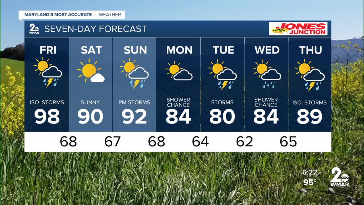
7 Day Forecast:
Friday Showers likely and possibly a thunderstorm. Increasing clouds and hot, with a high near 98. Heat index values as high as 105.
Friday Night Showers and thunderstorms likely. Mostly cloudy, with a low around 68.
Saturday Sunny, with a high near 91.
Saturday Night Mostly clear, with a low around 67.
Sunday A chance of showers and thunderstorms. Mostly sunny, with a high near 93.
Sunday Night A chance of showers and thunderstorms. Mostly cloudy, with a low around 68.
Monday Partly sunny, with a high near 84.
Monday Night A chance of showers. Mostly cloudy, with a low around 64.
Tuesday A chance of showers. Partly sunny, with a high near 80.
Tuesday Night A chance of showers. Mostly cloudy, with a low around 62.
Wednesday A chance of showers. Partly sunny, with a high near 84.
Wednesday Night A chance of showers and thunderstorms. Partly cloudy, with a low around 65.
Thursday A chance of showers and thunderstorms. Mostly sunny, with a high near 88.

