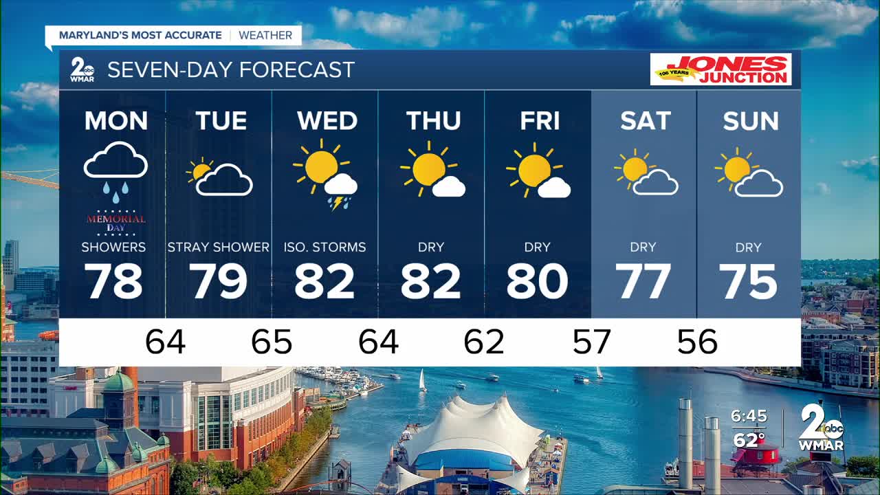


I wish we had better news for your Memorial Day, but we’re tracking another round of showers — especially early Monday morning. Satellite imagery shows a front moving across the Ohio Valley that will stall over the Mid-Atlantic on Monday, bringing periods of rain and the chance for a few thunderstorms. The best chance for showers looks to come during the morning hours.
Tuesday will be much drier, although clouds will linger through much of the day. Shower chances will be highest across southern Maryland.
Another front moves through Wednesday, and this time thunderstorms appear to be the main concern during the afternoon and evening hours as daytime heating peaks. Behind that front, a much drier air mass arrives, bringing back sunshine and more seasonable temperatures for the second half of the week.
– Dylan

Memorial Day
Showers and possibly a thunderstorm. Patchy fog before 10am. High near 77. West wind 3 to 6 mph. Chance of precipitation is 80%. New rainfall amounts of less than a tenth of an inch, except higher amounts possible in thunderstorms.
Monday Night
A chance of showers and thunderstorms before 1am, then a chance of showers after 3am. Mostly cloudy, with a low around 62. Calm wind. Chance of precipitation is 40%.
Tuesday
Showers likely, mainly before 7am. Mostly cloudy, with a high near 78. Calm wind. Chance of precipitation is 60%. New precipitation amounts between a tenth and quarter of an inch possible.
Tuesday Night
Mostly cloudy, with a low around 63. Calm wind.
Wednesday
A chance of showers, with thunderstorms also possible after 2pm. Partly sunny, with a high near 83. Chance of precipitation is 30%.
Wednesday Night
Mostly cloudy, with a low around 65.
Thursday
Mostly sunny, with a high near 81.
Thursday Night
Mostly clear, with a low around 58.
Friday
Sunny, with a high near 79.
Friday Night
Mostly clear, with a low around 57.
Saturday
Mostly sunny, with a high near 77.
Saturday Night
Mostly cloudy, with a low around 57.
Sunday
Partly sunny, with a high near 72.

