



Good Sunday night!
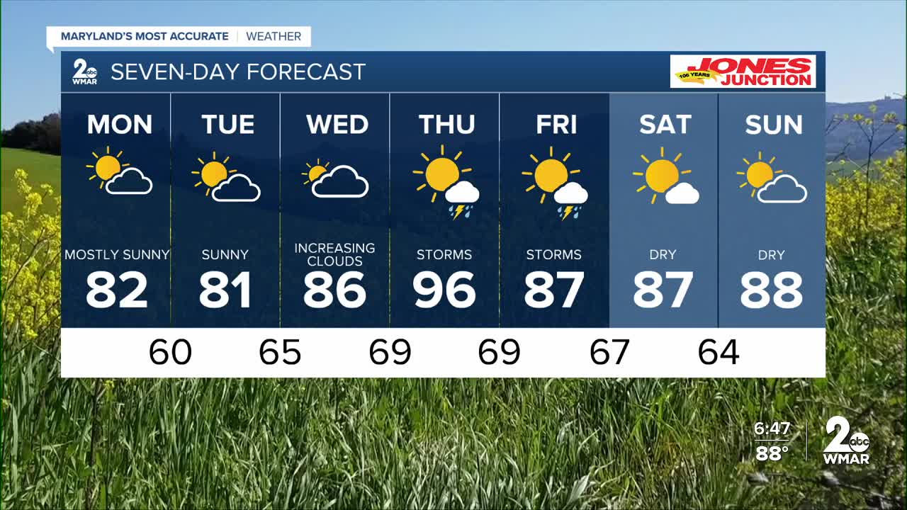
Monday and Tuesday bring a refreshing break with cooler temperatures and low humidity before heat, humidity, and the potential for strong thunderstorms return to the region by Thursday.
Expect much cooler and drier conditions throughout Monday. Mostly sunny skies will accompany high temperatures in the upper 70s to around 80 degrees. Humidity will remain very low with dewpoints in the 40s and 50s as winds blow from the northwest. While Tuesday remains quiet, humidity begins to climb on Wednesday with highs in the mid to upper 80s. A more significant weather system arrives on Thursday, bringing the potential for strong to severe thunderstorms. This system will be fueled by high humidity and temperatures as dew points climb back toward 70 degrees.
— Dylan

Monday
Mostly sunny, with a high near 81.
Monday Night
Mostly cloudy, with a low around 61.
Tuesday
A slight chance of showers. Partly sunny, with a high near 80. Chance of precipitation is 20%.
Tuesday Night
A slight chance of showers. Partly cloudy, with a low around 62. Chance of precipitation is 20%.
Wednesday
A slight chance of showers. Mostly sunny, with a high near 84. Chance of precipitation is 20%.
Wednesday Night
Partly cloudy, with a low around 66.
Thursday
A chance of showers and thunderstorms. Partly sunny, with a high near 93. Chance of precipitation is 50%.
Thursday Night
A chance of showers and thunderstorms. Partly cloudy, with a low around 70. Chance of precipitation is 30%.
Juneteenth
A chance of showers and thunderstorms. Mostly sunny, with a high near 90.

