

BALTIMORE — Happy Friday!
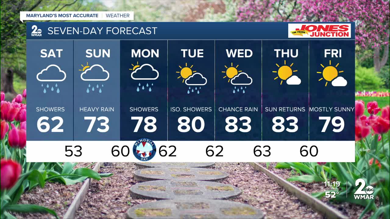
Rain continues this evening, easing us into the weekend set-up. It will be a rainy start to the holiday weekend with widespread showers on Saturday. High temperatures will remain in the 60s through Saturday before readings rise into the 70s on Sunday and Monday. More rain and possibly a thunderstorm or two are expected on Monday. Warming back into the 80s mid-week with drier skies.
7 Day Forecast:
Today Showers. High near 63. East wind 5-15 mph, with gusts as high as 20 mph.
Tonight Showers. Low around 50. East wind 5-15 mph, with gusts as high as 20 mph.
Saturday Showers, with thunderstorms. High near 62.
Saturday Night Showers and possibly a thunderstorm. Low around 53.
Sunday A chance of showers and thunderstorms. Mostly cloudy, with a high near 73.
Sunday Night A chance of showers. Mostly cloudy, with a low around 60.
Memorial Day A chance of showers. Mostly cloudy, with a high near 78.
Monday Night A chance of showers. Mostly cloudy, with a low around 62.
Tuesday A chance of showers. Mostly cloudy, with a high near 80.
Tuesday Night Mostly cloudy, with a low around 62.
Wednesday Mostly cloudy, with a high near 83.
Wednesday Night Mostly cloudy, with a low around 63.
Thursday Mostly sunny, with a high near 83.
Thursday Night Partly cloudy, with a low around 60.
Friday Mostly sunny, with a high near 79.

