

BALTIMORE — Good Wednesday night!
A strong line of showers and thunderstorms will move through the area between 7 p.m. and midnight. The threat for severe weather will remain mainly across western Maryland, but some storms elsewhere may still produce heavy downpours and gusty winds.
Thursday will feel much cooler, with stubborn clouds sticking around for much of the day. A brief sprinkle or two is possible, especially during the morning hours.
Our attention then quickly turns to the season’s first heat wave, expected to begin Monday and continue through Wednesday, with afternoon highs climbing into the 90-95° range.


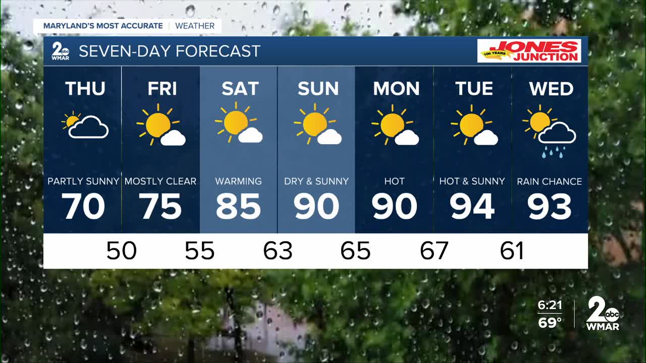
7 Day Forecast:
Tonight Showers and thunderstorms. Low around 53. South wind 5-10 mph becoming northwest after midnight.
Thursday Mostly sunny, with a high near 70.
Thursday Night Partly cloudy, with a low around 50.
Friday Mostly sunny, with a high near 75.
Friday Night Partly cloudy, with a low around 55.
Saturday Mostly sunny, with a high near 84.
Saturday Night Partly cloudy, with a low around 63.
Sunday Mostly sunny, with a high near 89.
Sunday Night Partly cloudy, with a low around 65.
Monday Mostly sunny, with a high near 91.
Monday Night Partly cloudy, with a low around 67.
Tuesday A chance of showers and thunderstorms. Mostly sunny, with a high near 93.
Tuesday Night Partly cloudy, with a low around 61.
Wednesday A chance of showers. Mostly sunny, with a high near 90.

