


BALTIMORE — Good Monday night,
Strong winds push through, with wind gusts could reach up to 55 mph, with the strongest winds likely occurring between 8 P.M. and midnight.
Temperatures will also drop rapidly behind the front. In fact, some locations across Maryland’s panhandle have already reported temperature drops of more than 10° in just five minutes!
A few snow flurries are also possible late tonight, but the good news is that sunshine returns by daybreak Tuesday.
Stay safe,
Dylan


7 Day Forecast:
Today Showers and thunderstorms. Some of the storms could be severe. High near 68. South wind 15-30 mph, with gusts as high as 30-40 mph.
Tonight Showers and possibly a thunderstorm. Some of the storms could be severe. Low around 30. West wind 5-15 mph, with gusts as high as 30 mph.
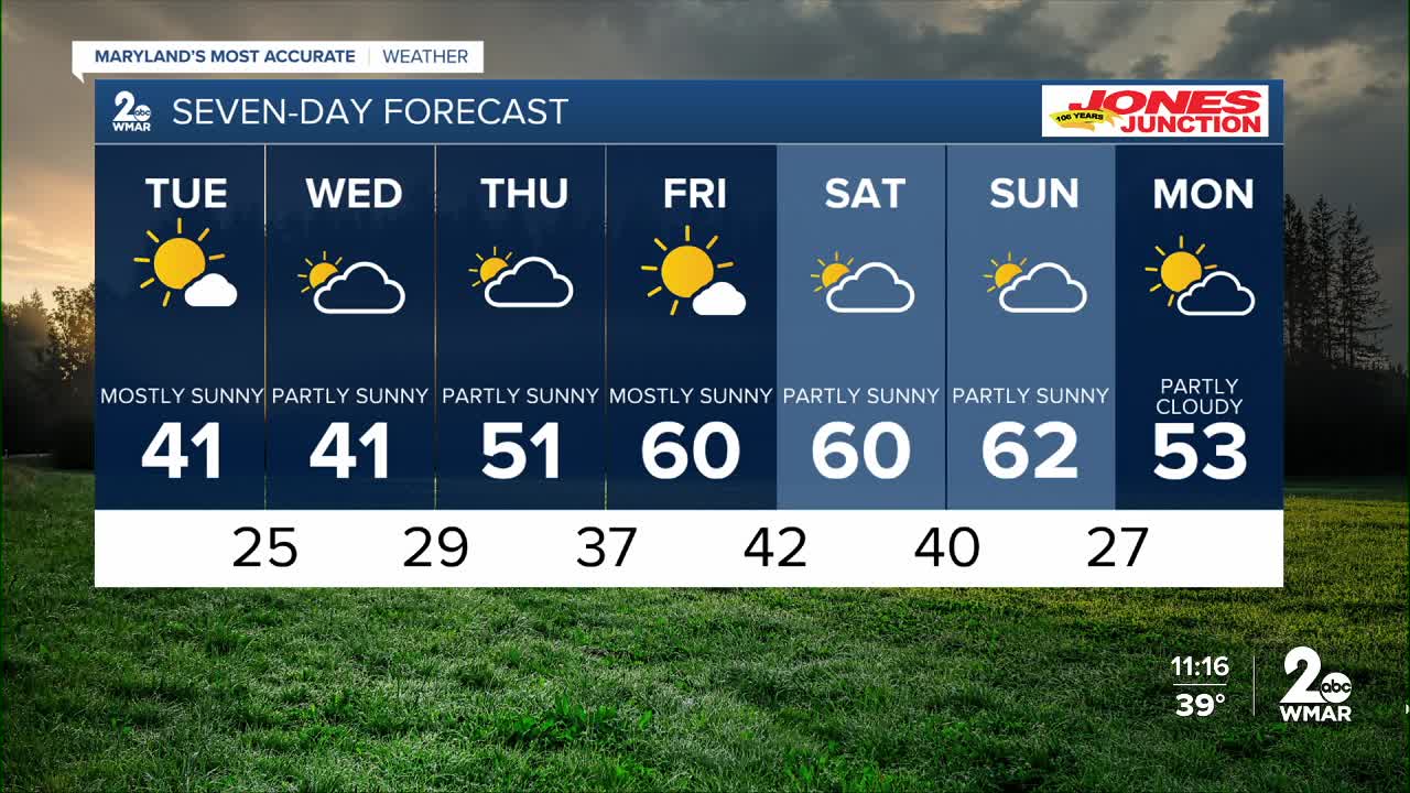
Tuesday Mostly sunny, with a high near 41.
Tuesday Night Mostly clear, with a low around 25.
Wednesday Mostly sunny, with a high near 41.
Wednesday Night Mostly cloudy, with a low around 29.
Thursday Partly sunny, with a high near 51.
Thursday Night Mostly cloudy, with a low around 37.
Friday Partly sunny, with a high near 60.
Friday Night Mostly cloudy, with a low around 42.
Saturday Partly sunny, with a chance of showers. A high near 60.
Saturday Night Partly cloudy, with a low around 40.
Sunday Partly sunny, with a chance of showers. A high near 58.

