

BALTIMORE — Happy Wednesday! There is a chance of a few pop-up showers this afternoon with seasonal temperatures, in the mid to upper-80s. Looking ahead, temperatures climb into the 90s by Thursday as humidity levels continue to rise. This will help fuel the potential for strong thunderstorms Thursday evening as a cold front moves through the region. Similar to last weekend, the primary threat with any stronger storms will be damaging wind gusts.
Have a sunny day!

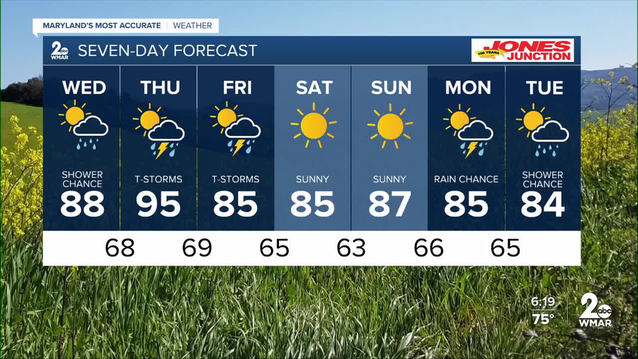
7 Day Forecast:
Wednesday Mostly cloudy through mid morning, then gradual clearing, with a high near 88. Southwest wind 5-15 mph.
Wednesday Night Partly cloudy, with a low around 70. South wind around 5-15 mph.
Thursday A slight chance of showers and thunderstorms. Partly sunny, with a high near 95.
Thursday Night A chance of showers and thunderstorms. Mostly cloudy, with a low around 69.
Juneteenth A chance of showers. Mostly sunny, with a high near 86.
Friday Night Mostly clear, with a low around 64.
Saturday Sunny, with a high near 86.
Saturday Night Mostly clear, with a low around 65.
Sunday Mostly sunny, with a high near 88.
Sunday Night A chance of showers and thunderstorms. Mostly cloudy, with a low around 66.
Monday Showers likely and possibly a thunderstorm. Mostly cloudy, with a high near 87.
Monday Night Showers and thunderstorms likely. Mostly cloudy, with a low around 65.
Tuesday A slight chance of showers. Mostly sunny, with a high near 86.

