


BALTIMORE — Happy Wednesday!
Another warm day, with high temperatures in the mid-80s. Scattered showers and thunderstorms develop this afternoon and evening. These storms could bring strong winds and hail, with the main activity expected between 3 PM - 11 PM. Cooler air works into the region behind the cold front on Thursday, with a lingering spotty shower or two. Temperatures will rebound back into the 80s on Friday and Saturday. Widespread rain showers are still expected to slide through on Easter Sunday during the late-afternoon/evening hours. Temperatures will return to seasonal levels early next week.
Stay weather aware!
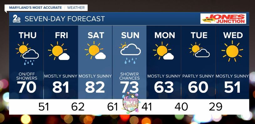
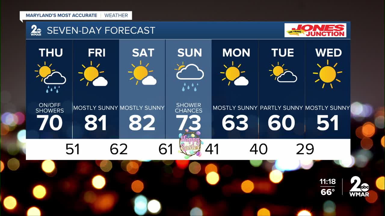
7 Day Forecast:
Today Scattered showers and thunderstorms. Increasing clouds, with a high near 85. Southwest wind around 5-10 mph.
Tonight Showers and possibly a thunderstorm. Patchy fog. Low around 57. Light and variable wind.
Thursday A chance of showers and thunderstorms. Patchy fog. Otherwise, mostly cloudy, with a high near 70.
Thursday Night A chance of showers and thunderstorms. Mostly cloudy, with a low around 51.
Friday Mostly sunny, with a high near 81.
Friday Night Partly cloudy, with a low around 62.
Saturday Mostly sunny, with a high near 82.
Saturday Night A chance of showers. Partly cloudy, with a low around 61.
Sunday Showers likely. Mostly cloudy, with a high near 73.
Sunday Night Showers likely. Mostly cloudy, with a low around 41.
Monday Mostly sunny, with a high near 63.
Monday Night Mostly clear, with a low around 40.
Tuesday Mostly sunny, with a high near 60.
Tuesday Night Partly cloudy, with a low around 29.
Wednesday Sunny, with a high near 51.

