



Good Monday night!
Satellite and radar imagery show a stalled front just to our north, and it will serve as the focus for showers and thunderstorms through the evening. The greatest threat for heavy rain will be before midnight. With rainfall rates of 1 to 2 inches per hour, localized flooding is possible, especially in poor drainage and low-lying areas.
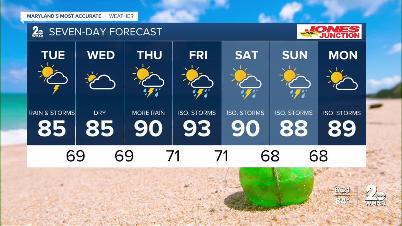
Scattered showers and thunderstorms will remain in the forecast on Tuesday, but the overall flooding threat will be much lower than tonight.
Looking ahead, Wednesday is shaping up to be the pick of the week! We'll finally get a break from the stormy pattern with a mix of sun and clouds. The humidity, however, isn't going anywhere just yet.
Dylan

Tuesday
A chance of showers and thunderstorms, mainly after 4pm. Mostly cloudy, with a high near 85.
Tuesday Night
A chance of showers and thunderstorms. Mostly cloudy, with a low around 69.
Wednesday
Partly sunny, with a high near 85.
Wednesday Night
Partly cloudy, with a low around 69.
Thursday
A slight chance of showers, then a chance of showers and thunderstorms after 2pm. Partly sunny, with a high near 90.
A chance of showers and thunderstorms before 2am. Mostly cloudy, with a low around 71.
Friday
A chance of showers and thunderstorms after 2pm. Mostly sunny, with a high near 93.
Friday Night
A chance of showers and thunderstorms. Mostly cloudy, with a low around 71.
Saturday
A chance of showers and thunderstorms. Partly sunny, with a high near 90.
Saturday Night
A chance of showers and thunderstorms. Partly cloudy, with a low around 68.
Sunday
A slight chance of showers and thunderstorms. Mostly sunny, with a high near 88.

