



BALTIMORE — Good Saturday to you!
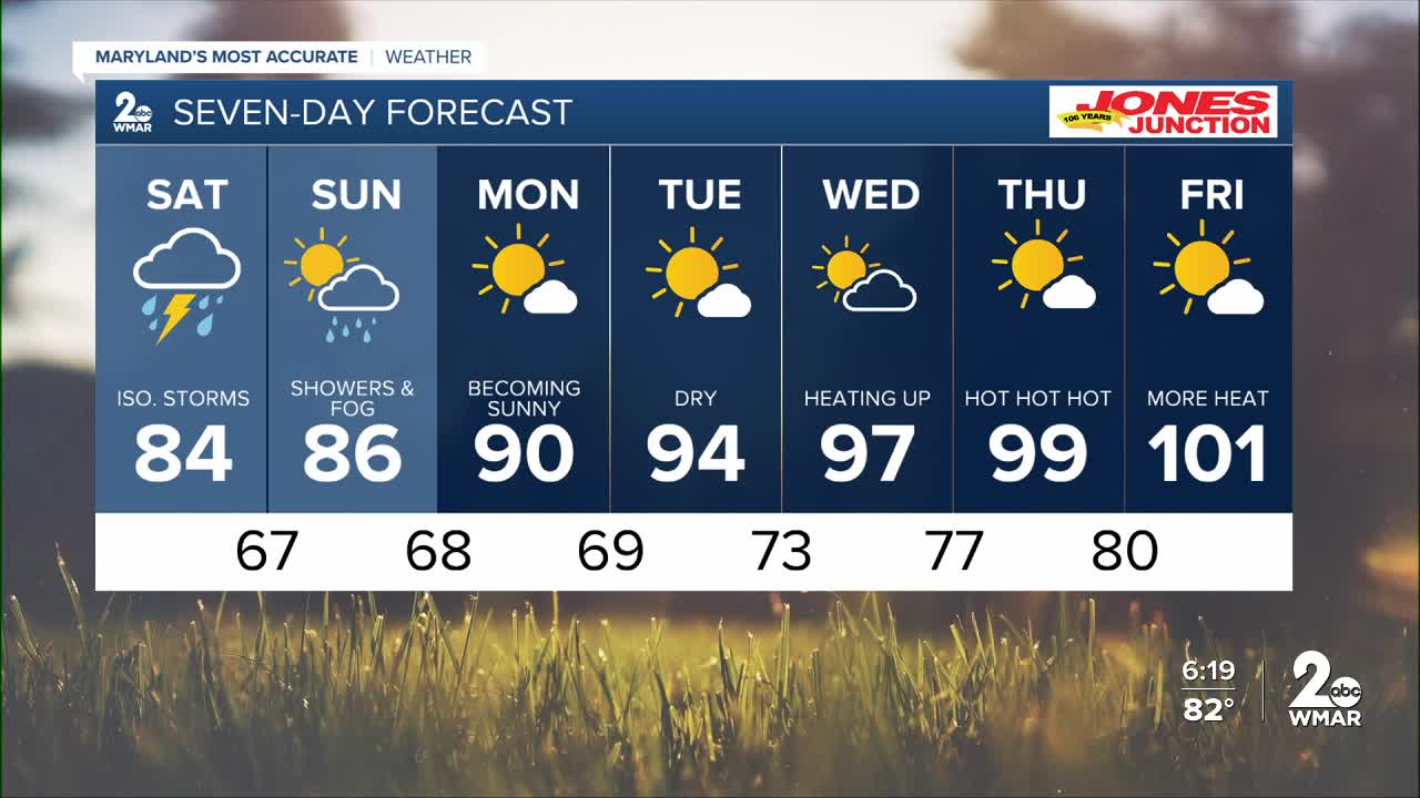
Rain is lingering in to our south this morning as temperatures settle into the 60s and 70s overnight. Rain starts picking up again, with a few isolated thunderstorms. Sunday will be in better shape as rain chances look isolated with gradually clearing skies. Rain is still possible for the entirety of the weekend. There will be a significant warm-up next week. Record-high temperatures could be challenged as temperatures rise into the triple digits.
7 Day Forecast:
Today A chance of showers. Mostly cloudy, with a high near 90. Southwest wind 5-10 mph.
Tonight A chance of showers and thunderstorms. Low around 68. South wind around 5-10 mph becoming northeast in the evening.
Saturday Showers, with thunderstorms also possible. High near 84.
Saturday Night A chance of showers and thunderstorms. Patchy fog. Otherwise, mostly cloudy, with a low around 67.
Sunday Mostly sunny, with a high near 86.
Sunday Night Partly cloudy, with a low around 68.
Monday Sunny, with a high near 90.
Monday Night Mostly clear, with a low around 69.
Tuesday Sunny, with a high near 94.
Tuesday Night Mostly clear, with a low around 73.
Wednesday A slight chance of showers and thunderstorms. Mostly sunny, with a high near 97.
Wednesday Night A slight chance of showers and thunderstorms. Partly cloudy, with a low around 77.
Thursday Sunny and hot, with a high near 99.
Thursday Night Mostly clear, with a low around 80.
Friday A slight chance of showers and thunderstorms. Sunny and hot, with a high near 100.

