

BALTIMORE — Good Tuesday night!
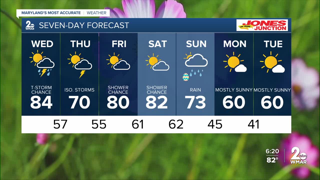
We’re tracking the risk of thunderstorms Wednesday afternoon and evening as a front moves through. These storms could bring strong winds and hail, with the main activity expected between 3 PM and 8 PM.
Temperatures will climb to near-record levels Wednesday, with highs in the mid-80s!
Thursday through Saturday will be cooler, before our attention turns to another front around Easter. Currently, this front is expected to bring mostly rain rather than severe storms. The exact timing is still uncertain, but models generally show the front moving through during the afternoon and evening—hopefully keeping Easter morning dry!
Enjoy,
Dylan


7 Day Forecast:
Wednesday Showers likely and possibly a thunderstorm. Increasing clouds, with a high near 84.
Wednesday Night Showers likely and possibly a thunderstorm. Mostly cloudy, with a low around 57.
Thursday A slight chance of showers. Partly sunny, with a high near 72.
Thursday Night A chance of showers. Mostly cloudy, with a low around 54.
Friday Partly sunny, with a high near 79.
Friday Night Mostly cloudy, with a low around 61.
Saturday A chance of showers. Partly sunny, with a high near 81.
Saturday Night A chance of showers. Mostly cloudy, with a low around 62.
Sunday A chance of showers. Mostly cloudy, with a high near 76.
Sunday Night A chance of showers. Mostly cloudy, with a low around 46.
Monday A chance of showers. Partly sunny, with a high near 61.
Monday Night Mostly clear, with a low around 41.
Tuesday Mostly sunny, with a high near 61.

