

BALTIMORE — The sunshine sticks around Friday, but temperatures will be much cooler! Some of you may even wake up to temperatures in the 40s Friday morning.
The weekend brings a warm-up, with highs reaching the mid 70s Saturday and the low 80s Sunday. Along with the warmer air will come increasing chances for showers and thunderstorms. Saturday looks to feature isolated activity, but by Sunday evening into Sunday night, a cold front will bring more widespread showers and a few storms capable of producing gusty winds. Much cooler air returns for Monday and Tuesday.
Side note: thanks to yesterday’s rain, tree pollen levels have dropped from very high to moderate. Unfortunately for allergy sufferers, pollen counts are expected to climb back to high levels by Friday afternoon!

7 Day Forecast:
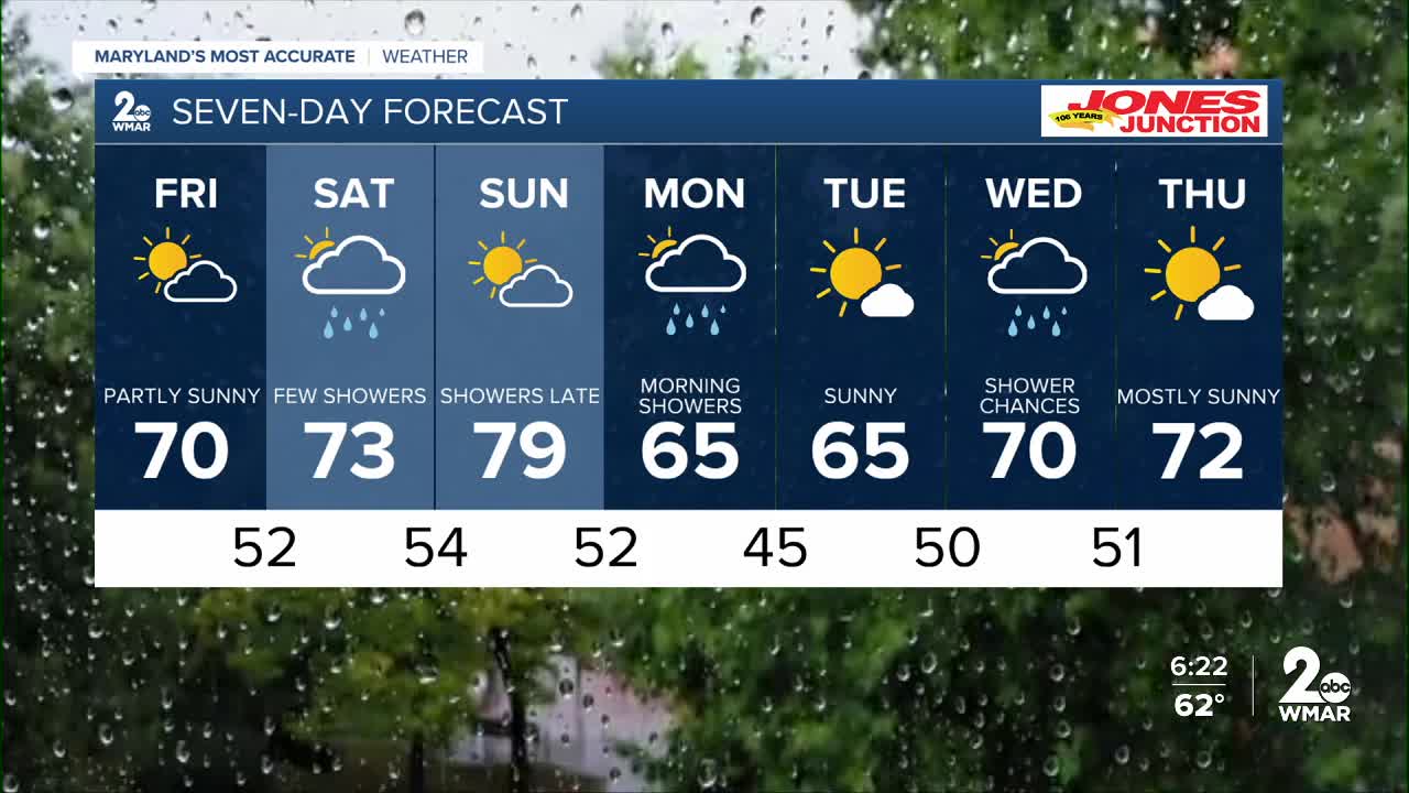
Friday Increasing clouds, with a high near 69.
Friday Night Mostly cloudy, with a low around 52.
Saturday Showers likely, with thunderstorms. Mostly cloudy, with a high near 72.
Saturday Night Mostly clear, with a low around 53.
Sunday A chance of showers. Mostly sunny, with a high near 79.
Sunday Night Showers likely. Mostly cloudy, with a low around 56.
Monday A chance of showers. Partly sunny, with a high near 70.
Monday Night Mostly clear, with a low around 47.
Tuesday Sunny, with a high near 68.
Tuesday Night A chance of showers. Partly cloudy, with a low around 49.
Wednesday A chance of showers. Partly sunny, with a high near 69.
Wednesday Night A chance of showers. Mostly cloudy, with a low around 51.
Thursday Mostly sunny, with a high near 72.

