

BALTIMORE — Good Tuesday night!
A weather disturbance will slide through Maryland on Wednesday, bringing the chance for showers and thunderstorms. A few brief showers may develop early in the day, but the risk for stronger storms will ramp up between 1 PM and 9 PM. The primary threats will be damaging wind gusts and hail.
Storm chances increase even further Thursday and Friday as heat, humidity, and instability continue to build. Similar to Wednesday, both days could feature strong to severe thunderstorms capable of producing damaging winds and hail.
Temperature-wise, we're looking at the hottest readings of the season so far on Thursday and Friday, with highs soaring into the 96–98°F range. Combined with dew points in the 70s, heat index values could approach or even exceed 105°F in some locations.
The weekend looks much more pleasant, with slightly cooler temperatures and plenty of sunshine both days!
Dylan

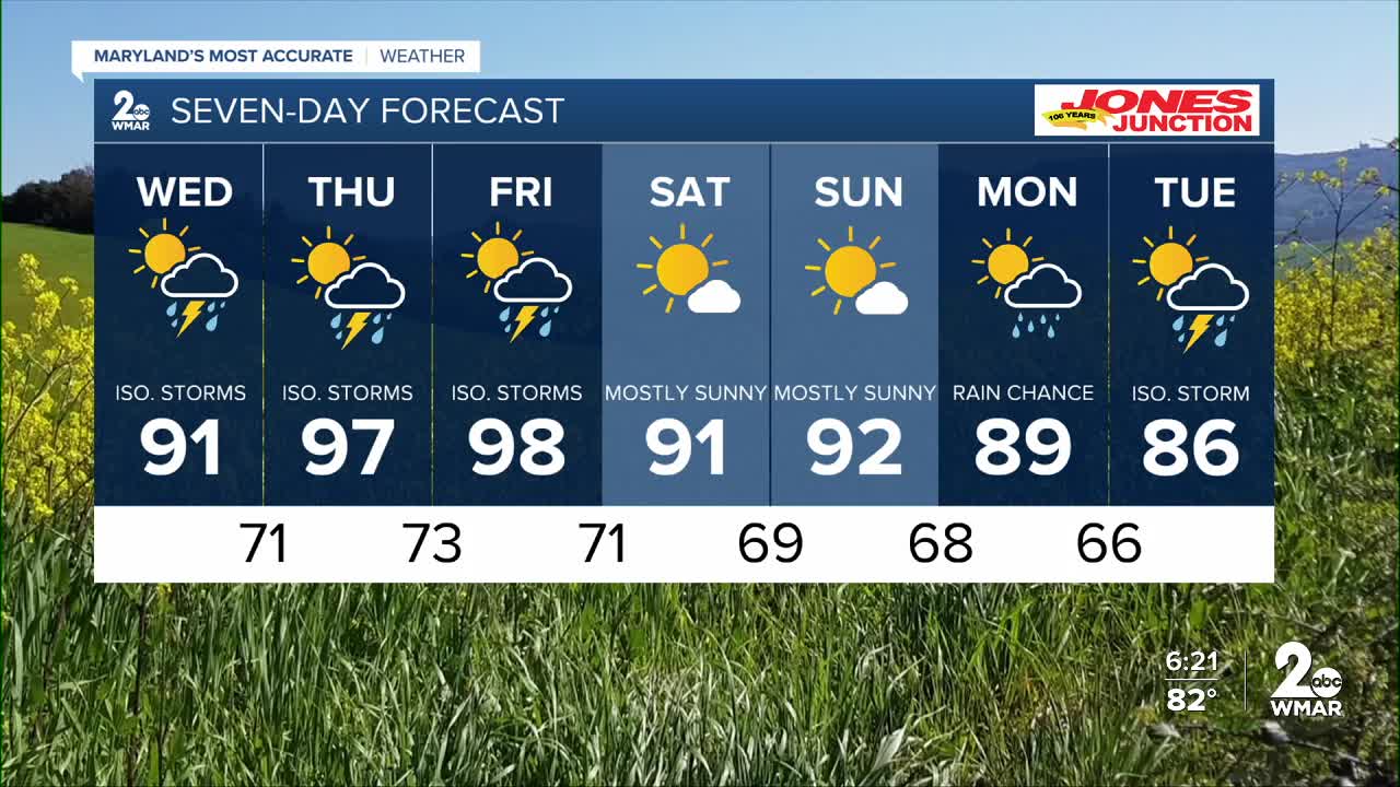
7 Day Forecast:
Wednesday A chance of showers, with thunderstorms also possible. Mostly cloudy, with a high near 91.
Wednesday Night A chance of showers and thunderstorms. Mostly cloudy, with a low around 71.
Thursday A chance of showers and thunderstorms. Mostly sunny, with a high near 97.
Thursday Night A chance of showers and thunderstorms. Mostly cloudy, with a low around 73.
Friday A chance of showers and thunderstorms. Partly sunny, with a high near 98.
Friday Night A chance of showers and thunderstorms. Mostly cloudy, with a low around 71.
Saturday Mostly sunny, with a high near 91.
Saturday Night Partly cloudy, with a low around 69.
Sunday Partly cloudy, with a high near 92.
Sunday Night Mostly cloudy, with a low around 68.
Monday A chance of showers. Partly sunny, with a high near 89.
Monday Night A chance of showers. Mostly cloudy, with a low around 66.
Tuesday A chance of showers and thunderstorms. Partly sunny, with a high near 84.

