



Good Tuesday night!
High pressure settles nearly overhead Tuesday night, bringing another comfortable evening to the Baltimore area. Light winds and low humidity will allow temperatures to fall into the mid-50s to mid-60s. Patchy fog is possible overnight, otherwise dry and quiet conditions are expected.
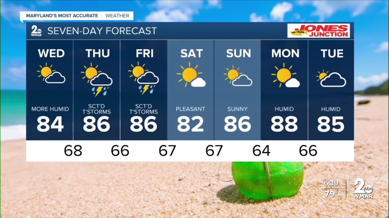
Changes begin Wednesday as winds turn out of the south, bringing warmer and more humid air back into the region. Highs climb into the upper 80s to near 90 degrees, with wind gusts up to 20 mph possible. A cold front approaches Thursday, bringing the next chance for thunderstorms. Some storms could become strong to locally severe, with damaging wind gusts the primary concern. A brief stretch of cooler weather is expected by Saturday.
Dylan

Tuesday Night
Mostly clear, with a low around 63. Northwest wind around 5 mph becoming calm in the evening.
Wednesday
Mostly sunny, with a high near 86. Calm wind becoming south 5 to 9 mph in the afternoon.
Wednesday Night
A slight chance of showers, then a chance of showers and thunderstorms after 11pm. Mostly cloudy, with a low around 68.
Thursday
A chance of showers and thunderstorms, then showers and possibly a thunderstorm after 2pm. High near 85.
Thursday Night
Showers and thunderstorms before 11pm, then a chance of showers between 11pm and 2am. Low around 66.
Friday
A chance of showers and thunderstorms after 2pm. Partly sunny, with a high near 85.
Friday Night
A chance of showers and thunderstorms before 8pm. Mostly cloudy, with a low around 67.
Saturday
Mostly sunny, with a high near 85.
Saturday Night
Partly cloudy, with a low around 67.
Sunday
Mostly sunny, with a high near 85.
Sunday Night
Partly cloudy, with a low around 64.
Monday
Mostly sunny, with a high near 87.

