

BALTIMORE — Good Thursday night!
A noticeable cooldown arrives Friday as a cold front moves through the region. Expect a few light showers to develop after midnight tonight, lingering into early Friday. Even beyond that, a stray sprinkle can’t be ruled out at times during the day.
We’ll catch a break on Saturday before a stronger cold front sweeps through Saturday night into Sunday. This system carries more moisture, so confidence is high that Sunday will be a wetter day.
Looking ahead, a more significant cooldown is expected next week as winds shift to the north.
— Dylan

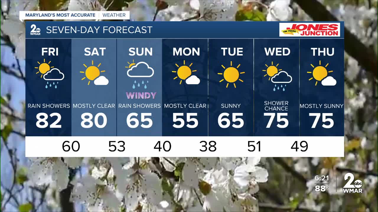
7 Day Forecast:
Friday A chance of showers. Partly sunny, with a high near 82.
Friday Night Mostly clear, with a low around 60.
Saturday Mostly sunny, with a high near 81.
Saturday Night A chance of showers. Mostly cloudy, with a low around 53.
Sunday Showers likely. Mostly cloudy, with a high near 70.
Sunday Night A chance of showers. Partly cloudy, with a low around 40.
Monday Sunny, with a high near 57.
Monday Night Mostly clear, with a low around 38.
Tuesday Sunny, with a high near 65.
Tuesday Night Mostly clear, with a low around 51.
Wednesday A chance of showers. Partly cloudy, with a high near 75.
Wednesday Night Partly cloudy, with a low around 49.
Thursday Mostly sunny, with a high near 73.

