

BALTIMORE — Friday starts with off and on rain in the morning, becoming steadier Friday afternoon and Friday Night as a front moves through the area. This rain is very helpful for the region's current severe drought and rainfall deficits. Rainfall continues into Saturday before tapering off Saturday Night, though low clouds and fog will stick around through Sunday morning. More rain and thunderstorms are expected Monday as a surface low moves through. High temperatures will gradually warm up each day, potentially reaching the 80s by Wednesday.
Dylan

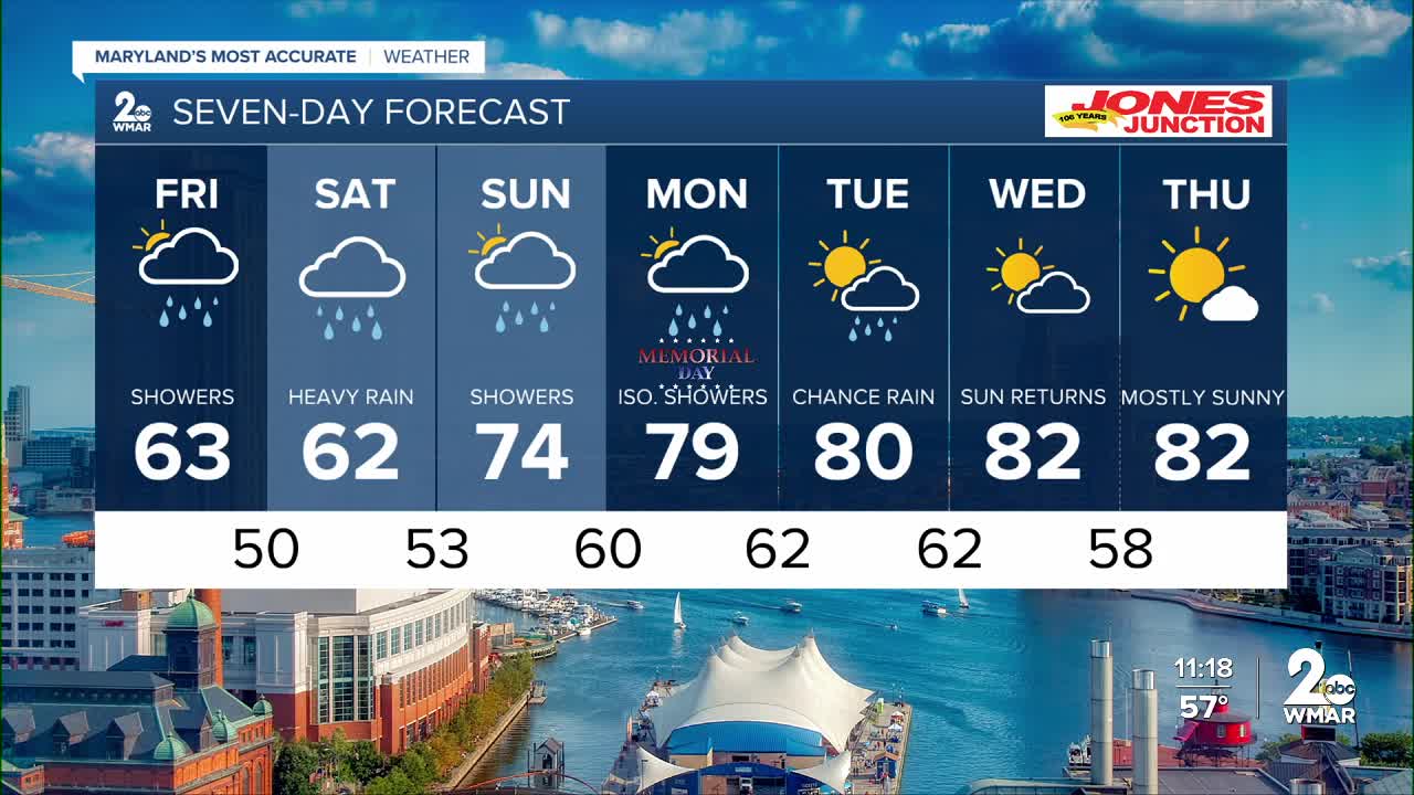
7 Day Forecast:
Friday Showers. High near 65.
Friday Night Showers. Low around 51.
Saturday Showers. High near 67.
Saturday Night Showers likely. Mostly cloudy, with a low around 55.
Sunday A chance of showers. Mostly cloudy, with a high near 73.
Sunday Night A chance of showers. Mostly cloudy, with a low around 59.
Memorial Day A chance of showers. Mostly cloudy, with a high near 79.
Monday Night A chance of showers. Mostly cloudy, with a low around 62.
Tuesday A chance of showers. Mostly cloudy, with a high near 80.
Tuesday Night Mostly cloudy, with a low around 62.
Wednesday Mostly cloudy, with a high near 82.

