

BALTIMORE — Happy Friday!
Near record-breaking heat today with triple-digit heat index values! A Heat Advisory is issued for areas northwest of the bay. Limit your time outdoors and check on your relatives/neighbors! Get ready for another round of strong-to-severe thunderstorms this afternoon and evening. Damaging wind gusts and hail will be the primary threats, though heavy rainfall and frequent lightning are also possible.
Stay safe!

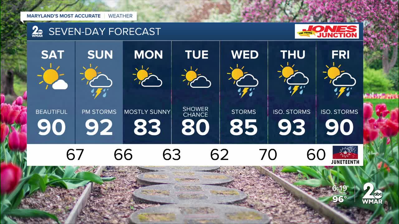
7 Day Forecast:
Today Showers and thunderstorms. Some of the storms could be severe. High near 98. Heat index values as high as 104. Light west wind increasing to 5-10 mph in the morning.
Tonight Showers and thunderstorms likely. Some of the storms could be severe. Mostly cloudy during the early evening, then gradual clearing, with a low around 67. Northwest wind around 5-10 mph.
Saturday Sunny, with a high near 90.
Saturday Night Mostly clear, with a low around 67.
Sunday Showers likely and possibly a thunderstorm. Partly sunny, with a high near 92.
Sunday Night Showers likely and possibly a thunderstorm. Mostly cloudy, with a low around 66.
Monday Mostly sunny, with a high near 83.
Monday Night A slight chance of showers. Partly cloudy, with a low around 63.
Tuesday A slight chance of showers, with thunderstorms also possible. Partly sunny, with a high near 80.
Tuesday Night A slight chance of showers and thunderstorms. Partly cloudy, with a low around 62.
Wednesday A chance of showers and thunderstorms. Mostly sunny, with a high near 85.
Wednesday Night A chance of showers and thunderstorms. Partly cloudy, with a low around 70.
Thursday A chance of showers and thunderstorms. Mostly sunny, with a high near 93.
Thursday Night A chance of showers and thunderstorms. Partly cloudy, with a low around 70.
Juneteenth A chance of showers and thunderstorms. Mostly sunny, with a high near 90.

