


BALTIMORE — Temperatures will fall near or slightly below freezing overnight. Freeze Warnings go into effect after midnight through 8 am Thursday morning for areas north and west of the metro. Make sure to protect your sensitive outdoor plants! Sunshine will make another appearance for Thursday with breezy northwest winds and highs in the low-60s. Temperatures will trend milder on Friday and into the weekend. Our next rain chance arrives Sunday night into Monday. The chance lingers into Tuesday.
Stay Tuned!
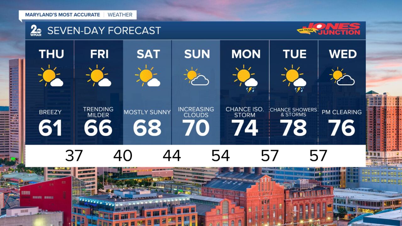
7 Day Forecast:
Tonight A chance of sprinkles before 8pm. Mostly clear, with a low around 35. Northwest wind 10 to 15 mph, with gusts as high as 23 mph.
Thursday Sunny, with a high near 61. Northwest wind 13 to 18 mph, with gusts as high as 26 mph.
Thursday Night Mostly clear, with a low around 37. Northwest wind 6 to 10 mph.
Friday Sunny, with a high near 66. Northwest wind 9 to 13 mph, with gusts as high as 21 mph.
Friday Night Mostly clear, with a low around 40.
Saturday Sunny, with a high near 68.
Saturday Night Partly cloudy, with a low around 44.
Sunday A chance of showers after 2pm. Partly sunny, with a high near 70. Chance of precipitation is 40%.
Sunday Night Showers likely, mainly between 8pm and 2am. Mostly cloudy, with a low around 54. Chance of precipitation is 60%.
Monday A chance of showers. Mostly cloudy, with a high near 74. Chance of precipitation is 40%.
Monday Night A chance of showers. Mostly cloudy, with a low around 57. Chance of precipitation is 40%.
Tuesday A chance of showers. Partly sunny, with a high near 78. Chance of precipitation is 40%.
Tuesday Night A chance of showers. Mostly cloudy, with a low around 57. Chance of precipitation is 30%.
Wednesday A chance of showers. Mostly sunny, with a high near 76.

