


Good Monday night!
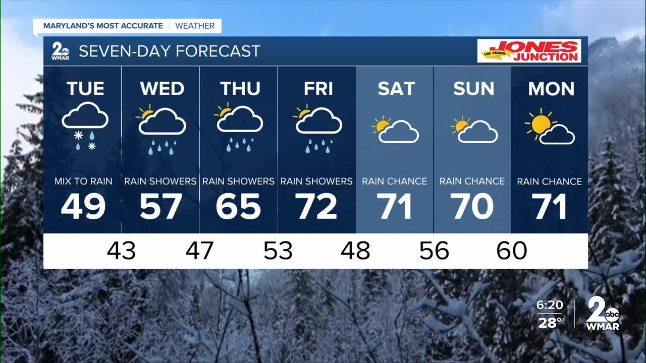
Be cautious overnight as snow, sleet, and freezing rain move through the area. Ice accumulation is expected to stay under a tenth of an inch, so while widespread travel issues aren’t anticipated, untreated roads could still become slick. Plan for a slower commute and allow a little extra time Tuesday morning.
By 7–9 AM Tuesday, precipitation transitions to all rain as temperatures climb into the 40s. Rain chances will linger through the rest of the week, with drier conditions returning just in time for the weekend.
Looking ahead, a significant warmup arrives late week, with highs soaring past the 70° mark!
Enjoy,
Dylan

Tuesday
Rain, possibly mixed with snow, becoming all rain after 10am. Patchy fog between 1pm and 4pm. High near 48.
Tuesday Night
Rain. Low around 42.
Wednesday
A chance of rain. Cloudy, with a high near 60.
Wednesday Night
A chance of rain. Cloudy, with a low around 47.
Thursday
A chance of rain after 1pm. Mostly cloudy, with a high near 70.
Thursday Night
A chance of rain. Mostly cloudy, with a low around 53.
Friday
A chance of rain. Partly sunny, with a high near 70.
Friday Night
Mostly cloudy, with a low around 48.
Saturday
A chance of rain. Mostly cloudy, with a high near 71.
Saturday Night
A chance of rain. Mostly cloudy, with a low around 56.
Sunday
A chance of rain. Partly sunny, with a high near 70.

