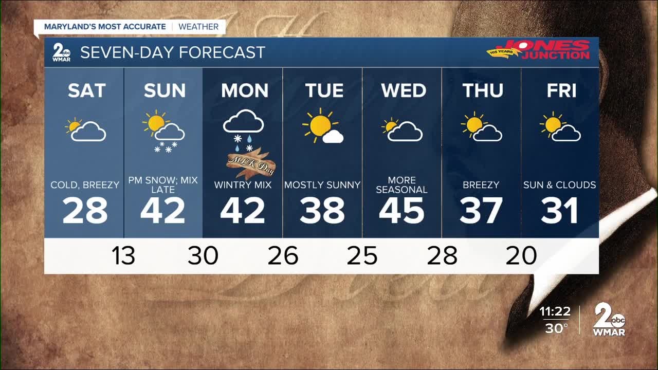


A Winter Storm Watch goes into effect for parts of our area Sunday afternoon. Heavy snow mixed precipitation possible. Total snow accumulations of 3 to 6 inches are most likely, with up to 8 inches possible. Ice accumulations of one to two tenths of an inch are possible. Winds could gust as high as 45 mph. Travel could be very difficult. The hazardous conditions could impact the Monday morning commute.

Snow will begin moving into the area Saturday afternoon. Snow may fall at 1 to 3 inches per hour late Sunday afternoon into Sunday evening, resulting in nearly impassable roads. Visibility may be reduced to a quarter mile or less at times.

As we head into the evening hours we are expecting a brief transition to wintry mix followed by southerly flow quickly changing precipitation over to rain over most of the area. Temperatures will increase through the evening and then drop again by Monday morning. A few snow showers are likely on that back end as the system begins moving northeast.

Now we see your comments on social media... and we know that you all don't like that every station in the city has a different forecast for snow totals. Every station has their own team of meteorologist that analyzes the data, model trends, and historical trends to put out their individual forecasts..
I want to preface our forecast with reminding you that we are #MarylandsMostAccurate weather team...
Now that we've got that out of the way — here's a look at what you can expect in your area:

#staytuned

