


BALTIMORE — Good Thursday night!
Winter Storm Watches have been issued for Maryland from Saturday evening through Monday morning. Snow is expected to begin between 6 PM and midnight Saturday night and continue steadily through midday Sunday.
Sunday afternoon becomes more complicated, as a band of freezing rain is forecast to move into the area. This freezing rain should remain closer to the harbor and coastal regions, meaning locations farther northwest are more likely to see additional snow instead.
Freezing rain will be a major concern on Sunday, as ice accumulations of a quarter to a half inch could bring down trees and power lines. Now is a good time to stock up on batteries, flashlights, and candles.


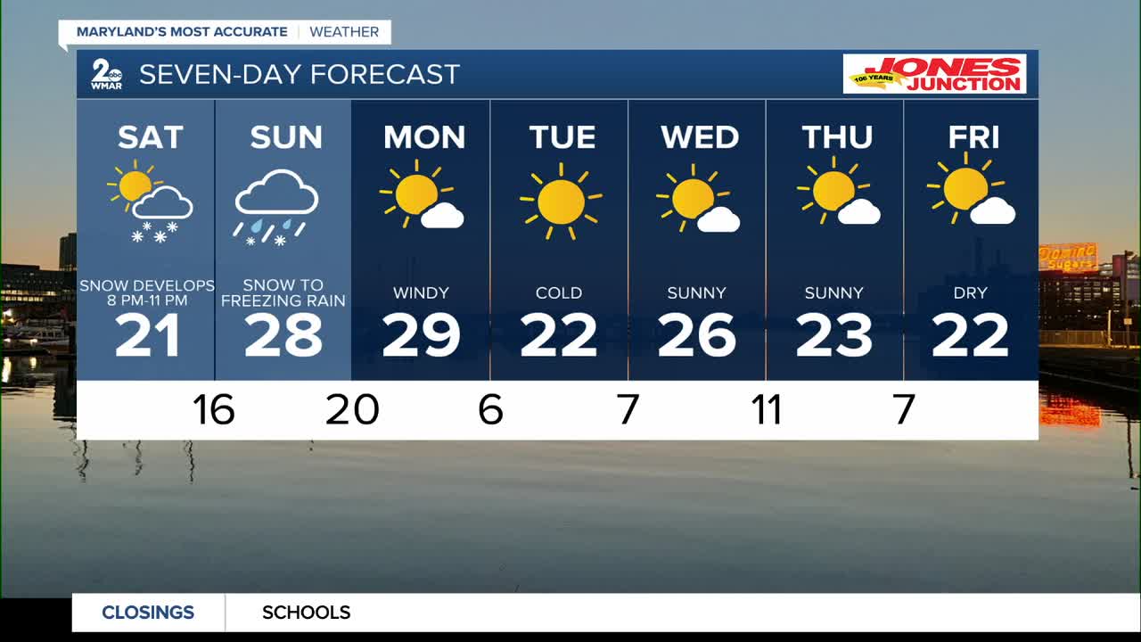
7 Day Forecast:
Friday Partly sunny, with a high near 42.
Friday Night Mostly cloudy, with a low around 10.
Saturday Mostly cloudy, with a high near 20.
Saturday Night Snow. The snow could be heavy at times. Low around 14.
Sunday Snow, then snow and sleet. High near 24.
Sunday Night Snow, freezing rain, and sleet likely. Mostly cloudy, with a low around 17.
Monday Mostly sunny, with a high near 27.
Monday Night Mostly clear, with a low around 6.
Tuesday Sunny, with a high near 25.
Tuesday Night Partly cloudy, with a low around 11.
Wednesday Partly cloudy, with a high near 31.

