


Good Sunday night!
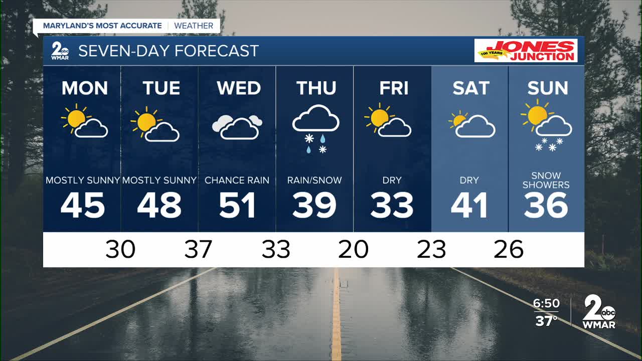
We’re in for some gorgeous weather over the next couple of days as high pressure builds in overhead. Winds were pretty strong today, but they’ll ease up by Monday afternoon.
Things turn more active starting Wednesday and continuing into Thursday. Rain showers arrive Wednesday as a strong cold front moves through the area. As colder air rushes in behind it, there are some signals that rain could mix with or even change over to snow on Thursday. It’s still too early to know if any accumulation will happen, but a few long-range models are hinting that it’s something to keep an eye on.
Looking ahead, we’re also tracking another chance for snow showers later next weekend.
More updates to come!
— Dylan

Monday
Mostly sunny, with a high near 44. Southwest wind 6 to 9 mph.
Monday Night
Partly cloudy, with a low around 30. Light west wind.
Tuesday
Mostly sunny, with a high near 48. Calm wind becoming south 5 to 7 mph in the afternoon.
Tuesday Night
Mostly cloudy, with a low around 38. Southwest wind around 7 mph.
Wednesday
A chance of rain. Mostly cloudy, with a high near 51. Chance of precipitation is 30%.
Wednesday Night
A chance of rain. Mostly cloudy, with a low around 34. Chance of precipitation is 50%.
Thursday
A chance of rain. Mostly cloudy, with a high near 41. Chance of precipitation is 50%.
Thursday Night
A chance of rain and snow before 1am. Mostly cloudy, with a low around 21. Chance of precipitation is 30%.
Friday
Mostly sunny, with a high near 35.
Friday Night
Partly cloudy, with a low around 24.
Saturday
Partly sunny, with a high near 40.
Saturday Night
Mostly cloudy, with a low around 26.
Sunday
A chance of snow. Partly sunny, with a high near 37. Chance of precipitation is 30%.

