

You’ve probably been hearing a lot of buzz about possible snow this weekend, January 17th–18th… but how much truth is there to those rumors?
We’re tracking two separate storm systems, and both are a bit tricky to forecast—each for very different reasons.
System #1 arrives early Saturday morning.
This is what we call an Alberta Clipper, a fast-moving system that drops down from Canada. Clippers are typically moisture-starved, which means they often bring little more than a quick burst of light snow—if anything at all.
Right now, this system could bring a brief mix of rain and snow to parts of Maryland Saturday morning. However, these systems have a tendency to underperform, especially on our side of the mountains where moisture often struggles to make it through. Bottom line: expect a few flakes at best, with little to no accumulation.

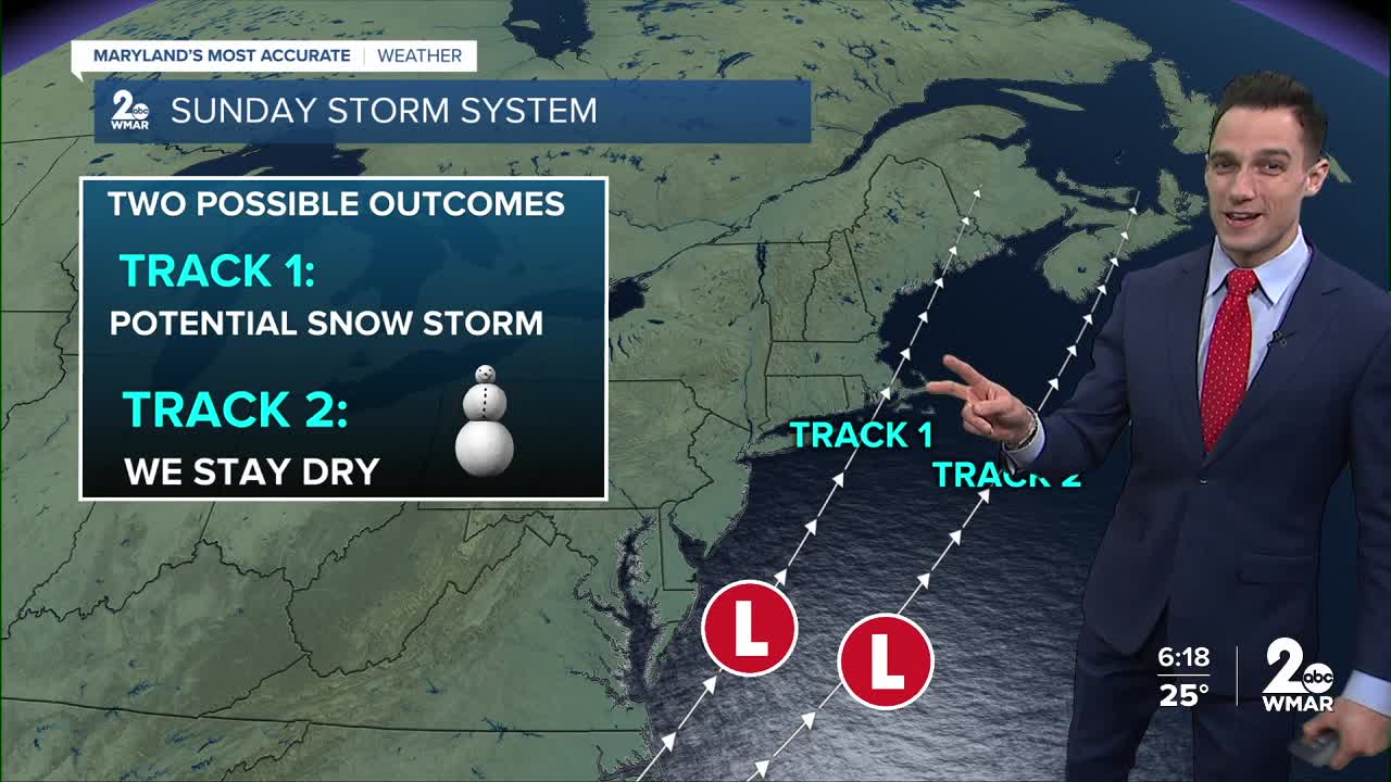
System #2 moves in Sunday—and this one has more potential.
This storm develops to our south, and southern systems usually raise more eyebrows because they carry more moisture. We’ll also have plenty of cold air in place, so if this system tracks close enough, it would fall as snow.
That said, as of Thursday night, forecast models have shifted this storm farther east. That likely means many areas in Maryland won’t see any snow at all. The best chance right now would be closer to the Delmarva Peninsula. However, if the storm were to shift just 50 miles west—closer to the I-95 corridor—we could quickly be talking about accumulating snow.


No matter how this weekend shakes out, one thing is certain: the cold is coming. We’re heading into the coldest stretch of the winter so far, with the chilliest temperatures expected between Sunday and Wednesday.


So keep the coats, hats, and gloves handy… winter is about to remind us it’s still very much in charge.
Bundle up!
—Dylan ❄️

