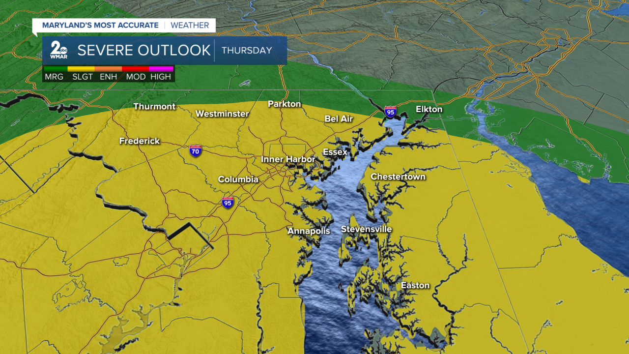


BALTIMORE — Most of our area is under a slight risk (a level 2 out of 5) for severe weather on Thursday. We expect two rounds of storms and showers with the second round being stronger. All types of severe - damaging wind, hail, and even an isolated tornado - are all possible.
There are some limiting factors though too.
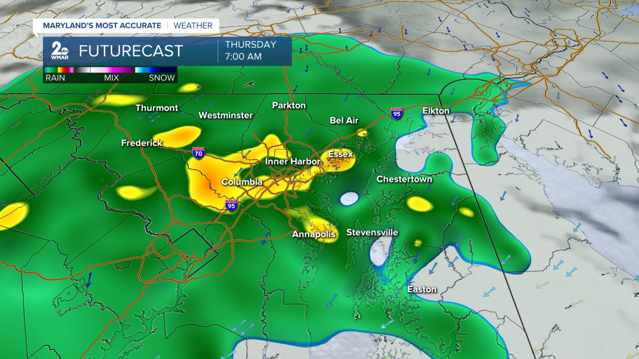
There will be a round of storms and showers Thursday morning. That will sap energy from the atmosphere. If it takes too much, our afternoon severe potential will be more limited. This is what we are hoping for, but it isn't a guarantee.
If we get enough sunshine in the afternoon and recharge the sky, storms will be stronger.
Here are the severe potentials we expect.
Damaging wind is the greatest threat with storms capable of producing 60 MPH winds. This is a 5-15% chance within 25 miles of any point.

Hail is also possible - up to an inch in diameter. It is a 5% chance within 25 miles of any point.

And finally there is a low end chance for an isolated tornado, but it isn't 0. Areas in the green have a 2% chance within 25 miles of a point.

We are hoping for the best! If morning storms and showers are too much, our severe potential will be limited. That being said it is always best to prepare for the worst. Have a way to get alerts and we will keep you posted on Thursday's storms.

