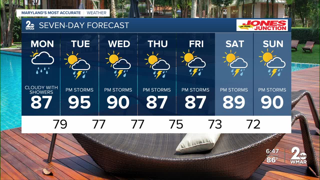


The remnants of Tropical Storm Chantal will bring showers to the region over the next few days!
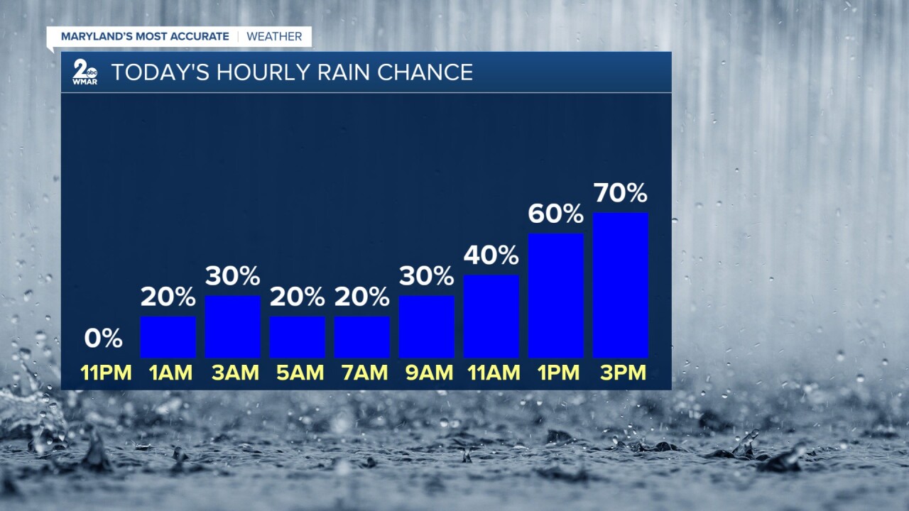
Rain is set to move in sometime late Monday and continue off and on through Tuesday. After Chantal moves out of the region, an approaching front will be the breeding ground for afternoon showers and storms each day this week.
By the end of the week, many of you will receive 2-3" of new rainfall, with locally higher amounts possible within the storms!
Clouds will be thick on Monday, which will keep temps in check, but expect a major warm up on Tuesday as there will be more sunshine!
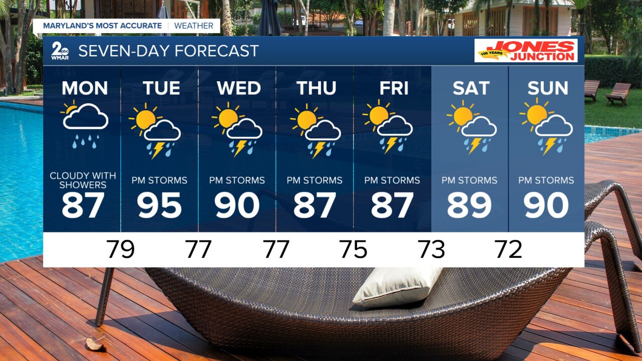
Monday
A slight chance of showers, then a chance of showers and thunderstorms after 2pm. Partly sunny, with a high near 90. Chance of precipitation is 40%.
Monday Night
A chance of showers and thunderstorms before 8pm. Partly cloudy, with a low around 74. Chance of precipitation is 30%.
Tuesday
A chance of showers and thunderstorms after 2pm. Mostly sunny, with a high near 91. Chance of precipitation is 30%.
Tuesday Night
A chance of showers and thunderstorms before 8pm. Partly cloudy, with a low around 72. Chance of precipitation is 30%.
Wednesday
A chance of showers and thunderstorms after 2pm. Partly sunny, with a high near 89. Chance of precipitation is 30%.
Wednesday Night
A chance of showers and thunderstorms. Mostly cloudy, with a low around 72. Chance of precipitation is 30%.
Thursday
Showers likely and possibly a thunderstorm. Mostly cloudy, with a high near 87. Chance of precipitation is 60%.
Thursday Night
Showers and thunderstorms likely. Mostly cloudy, with a low around 71. Chance of precipitation is 60%.
Friday
A chance of showers and thunderstorms. Partly sunny, with a high near 88. Chance of precipitation is 50%.

