


BALTIMORE — Good Tuesday night!
After our coldest night of the season so far, we can look forward to milder temperatures on Wednesday. The trade-off? We’ll be dealing with several rounds of showers throughout the day.
If you’re commuting before sunrise, conditions should stay dry. Showers, however, will move in shortly afterward—and you may even see a few sleet pellets or wet snowflakes mixing in.

Thursday is shaping up to be dry, but a weak system will pass just to our west on Friday. The latest computer models (as of 5 PM today) have increased confidence that this system will bring snow showers. Accumulations look to be very light, but enough to add a touch of Christmas to the landscape!

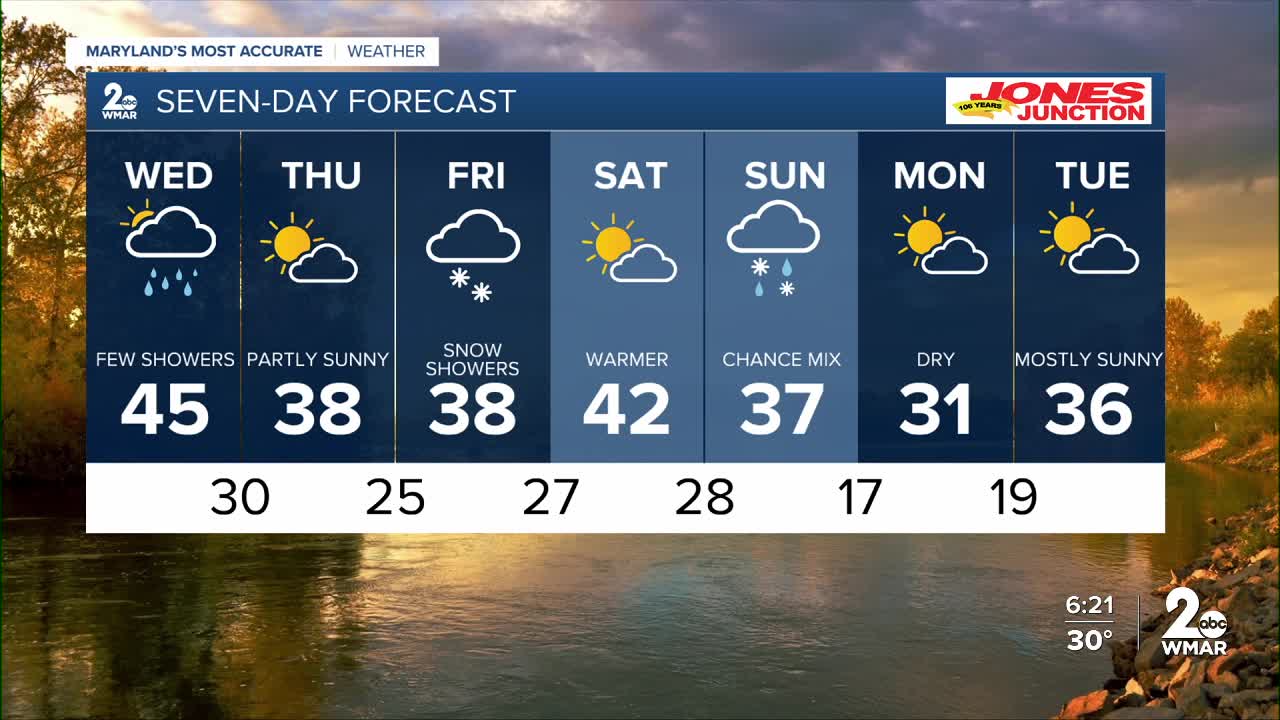
7 Day Forecast:
Wednesday A chance of light rain. Mostly cloudy, with a high near 48.
Wednesday Night Partly cloudy, with a low around 32.
Thursday Partly cloudy, with a high near 42.
Thursday Night Partly cloudy, with a low around 26.
Friday Partly sunny, with a high near 40.
Friday Night A chance of snow. Mostly cloudy, with a low around 28.
Saturday Partly cloudy, with a high near 41.
Saturday Night A chance of snow. Mostly cloudy, with a low around 24.
Sunday Mostly cloudy, with a chance of rain and snow. A high near 35.
Sunday Night Mostly clear, with a low around 17.
Monday Partly cloudy, with a high near 33.

