


BALTIMORE — Good Wednesday night!
A cold front will slide through the area tonight, which will drastically cool us down by Thursday. You can expect a gorgeous day tomorrow with abundant sunshine!
Another front slides through late Friday night, which will bring another round of spotty drizzle. The front is moving very fast, which means the rain will exit early Saturday, which will leave us dry for the rest of the day.
Our Sunday storm system will pack a bit more of a punch with it, which means Sunday is trending wetter.
Looking ahead, our long range models suggest a shot of cold air will arrive Monday, and last through most of next week. Nighttime lows will fall below freezing in Baltimore City and the 20s west of town. Although you've heard your fair share of chatter regarding snow on social media, we're not looking at any flurries in our viewing area. There may be a few flurries in the mountains across western Maryland and West Virginia.

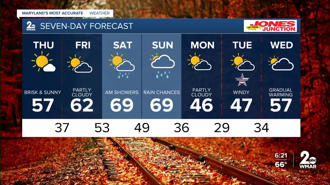
7 Day Forecast:
Thursday Sunny, with a high near 59.
Thursday Night Mostly clear, with a low around 38.
Friday Mostly sunny, with a high near 63.
Friday Night Rain likely. Mostly cloudy, with a low around 53.
Saturday Mostly sunny, with a high near 68.
Saturday Night Partly cloudy, with a low around 47.
Sunday A chance of rain. Partly sunny, with a high near 67.
Sunday Night A chance of rain. Mostly cloudy, with a low around 36.
Monday Mostly sunny, with a high near 48.
Monday Night Partly cloudy, with a low around 32.
Veterans Day Mostly sunny, with a high near 47.
Tuesday Night Partly cloudy, with a low around 35.
Wednesday Mostly sunny, with a high near 57.
Tuesday Night Partly cloudy, with a low around 37.
Wednesday Mostly sunny, with a high near 57.

