

Good Sunday night!
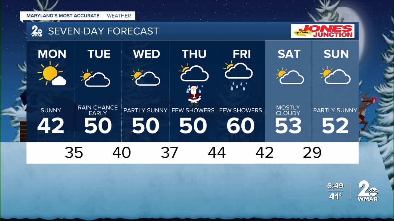
Mother Nature has a beautiful Monday lined up, making any last-minute Christmas shopping easy and stress-free.
Clouds will gradually increase Monday afternoon as a weak system moves in Monday night. While this system doesn’t have much moisture to work with, it could still bring a few rain showers overnight—possibly mixing with a bit of snow at times.
Tuesday and Wednesday look dry and noticeably warmer, giving us a nice midweek break.
Another front is expected to arrive on Christmas Day and could linger into the day after, bringing a chance for showers. It may not feel like a classic white Christmas, but the good news is holiday travel should stay smooth.
The big weather headline this week? The warmth. High temperatures are on track to climb past 60°F by the end of the week!

Monday
Increasing clouds, with a high near 43. Calm wind becoming west around 5 mph in the afternoon.
Monday Night
A chance of snow and sleet between 1am and 4am, then a chance of rain, snow, and sleet after 4am. Cloudy, with a low around 33. Calm wind becoming south around 6 mph after midnight. Chance of precipitation is 40%.
Tuesday
A chance of rain before 7am. Mostly cloudy, with a high near 49. South wind around 7 mph. Chance of precipitation is 30%.
Tuesday Night
Partly cloudy, with a low around 38. West wind around 6 mph.
Wednesday
Sunny, with a high near 50.
Wednesday Night
A chance of rain after 1am. Mostly cloudy, with a low around 36. Chance of precipitation is 30%.
Christmas Day
A chance of rain before 1pm. Mostly cloudy, with a high near 51. Chance of precipitation is 40%.
Thursday Night
Mostly cloudy, with a low around 44.
Friday
A chance of rain. Mostly cloudy, with a high near 61. Chance of precipitation is 40%.
Friday Night
A chance of rain. Mostly cloudy, with a low around 40. Chance of precipitation is 30%.
Saturday
Mostly cloudy, with a high near 51.
Saturday Night
Mostly cloudy, with a low around 37.
Sunday
A chance of rain. Mostly cloudy, with a high near 51. Chance of precipitation is 30%.

