

BALTIMORE — Good Tuesday evening! Expect the return of partial sunshine on Wednesday, along with a few afternoon storms. Temperatures will be much warmer, with highs in the 90s. Our attention quickly turns to a robust cold front that will move through Thursday. Along and ahead of this boundary will be thunderstorms, and a few could be severe! The risk of hail, damaging winds, and even a few tornadoes may be possible.

Heading into the weekend, a major heat wave is expected. Temperatures will reach the middle 90s starting Sunday, and near the century mark by Monday and Tuesday. Heat indices will reach 107° which could increase the risk of heat related illness.


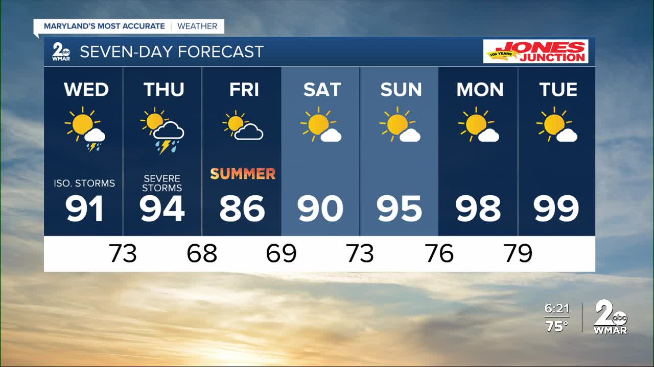
7 Day Forecast:
Wednesday A slight chance of showers and possibly a thunderstorm. High near 92.
Wednesday Night Showers and possibly a thunderstorm. Low around 73.
Juneteenth Showers likely and possibly a thunderstorm. Sunny, with a high near 94.
Thursday Night Showers likely and possibly a thunderstorm. Partly cloudy, with a low around 68.
Friday Mostly sunny, with a high near 88.
Friday Night Partly cloudy, with a low around 69.
Saturday Mostly sunny, with a high near 92.
Saturday Night Partly cloudy, with a low around 74.
Sunday Mostly sunny, with a high near 96.
Sunday Night Mostly clear, with a low around 76.
Monday Mostly sunny, with a high near 98.
Monday Night Mostly clear, with a low around 79.
Tuesday Sunny and hot, with a high near 97.

