



Happy Friday!
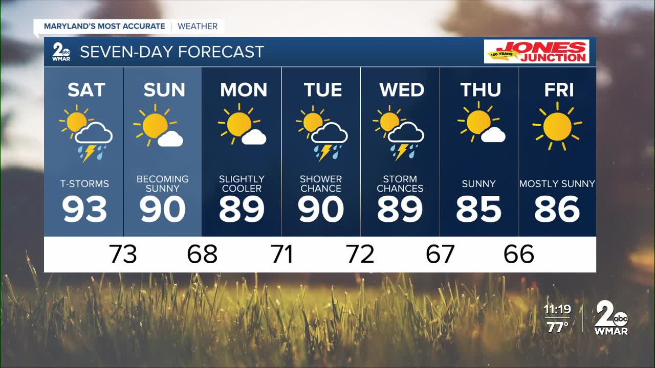
The entire area is under a Code Purple Air Quality alert today due to thick wildfire smoke descending from Canada. Temperatures will rise into the mid-90s today and will slightly decline this weekend, with an increased risk for showers and thunderstorms. Saturday appears to have the greatest chance for a couple rounds of thunderstorms during the day. Some of the thunderstorms could become strong to severe, especially during the afternoon. The cold front sags southward into Sunday, which will dry out conditions and lower humidity. After a dry and seasonal start to the work week, rain and storm chances increase midweek.
Stay safe out there!

7 Day Forecast:
Today Widespread smoke. Mostly sunny, with a high near 94. Light north wind.
Tonight A slight chance of showers and thunderstorms. Increasing clouds, with a low around 73. Southeast wind around 5-10 mph becoming calm in the evening.
Saturday A chance of showers and thunderstorms. Widespread smoke. High near 93.
Saturday Night Showers and possibly a thunderstorm. Low around 73.
Sunday A chance of showers. Mostly sunny, with a high near 90.
Sunday Night Mostly clear, with a low around 68.
Monday Sunny, with a high near 89.
Monday Night Partly cloudy, with a low around 71.
Tuesday A chance of showers, with thunderstorms also possible. Partly sunny, with a high near 90.
Tuesday Night A chance of showers and thunderstorms. Mostly cloudy, with a low around 72.
Wednesday A chance of showers and thunderstorms. Mostly sunny, with a high near 89.
Wednesday Night A chance of showers and thunderstorms. Partly cloudy, with a low around 67.
Thursday Mostly sunny, with a high near 85.
Thursday Night Mostly clear, with a low around 66.
Friday A slight chance of showers. Mostly sunny, with a high near 86.

