


Good Tuesday evening,
The severe storm threat has ended for tonight, but we are still tracking the potential of flooding.
Some of you have picked up between 1-2" of rain already today, and our high resolution model shows an additional 1.5-2.5" of rain could be on the way tonight. Remember to never drive through standing water on the roadways!

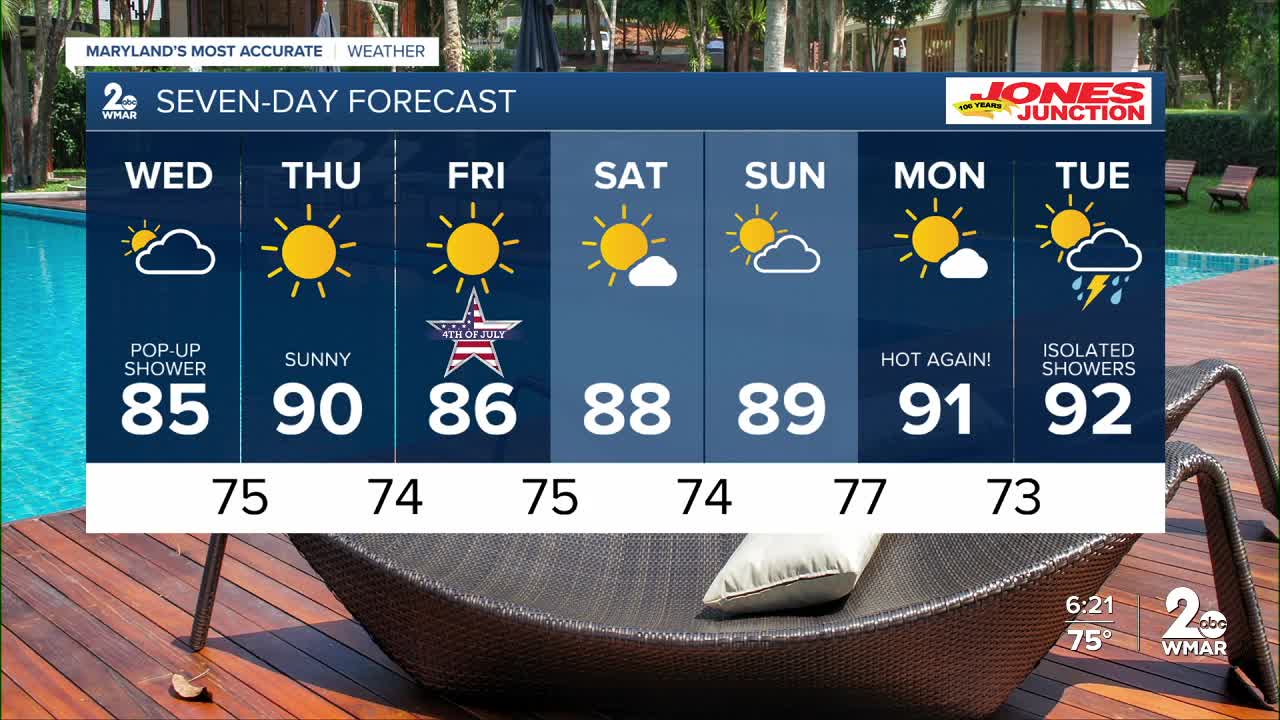
Expect a cloudy start to Wednesday, with gradual decreasing clouds as we go into the afternoon hours. There is a 20% chance of a stray shower on Wednesday.
The Fourth of July weekend is looking fantastic! It'll be sunny and dry for the three day weekend!
Enjoy!

Wednesday Cloudy, then gradually becoming mostly sunny, with a high near 85.
Wednesday Night Partly cloudy, with a low around 75.
Thursday Sunny, with a high near 89.
Thursday Night Mostly clear, with a low around 74.
Independence Day Sunny, with a high near 89.
Friday Night Mostly clear, with a low around 75.
Saturday Mostly sunny, with a high near 90.
Saturday Night Partly cloudy, with a low around 74.
Sunday Mostly sunny, with a high near 92.
Sunday Night Partly cloudy, with a low around 77.
Monday Mostly sunny, with a high near 94.

