


Happy Sunday night! I'm meteorologist Dylan Robichaud, and I've got to tell you that after a dry stretch of weather, we've got some spooky weather arriving right before Halloween!
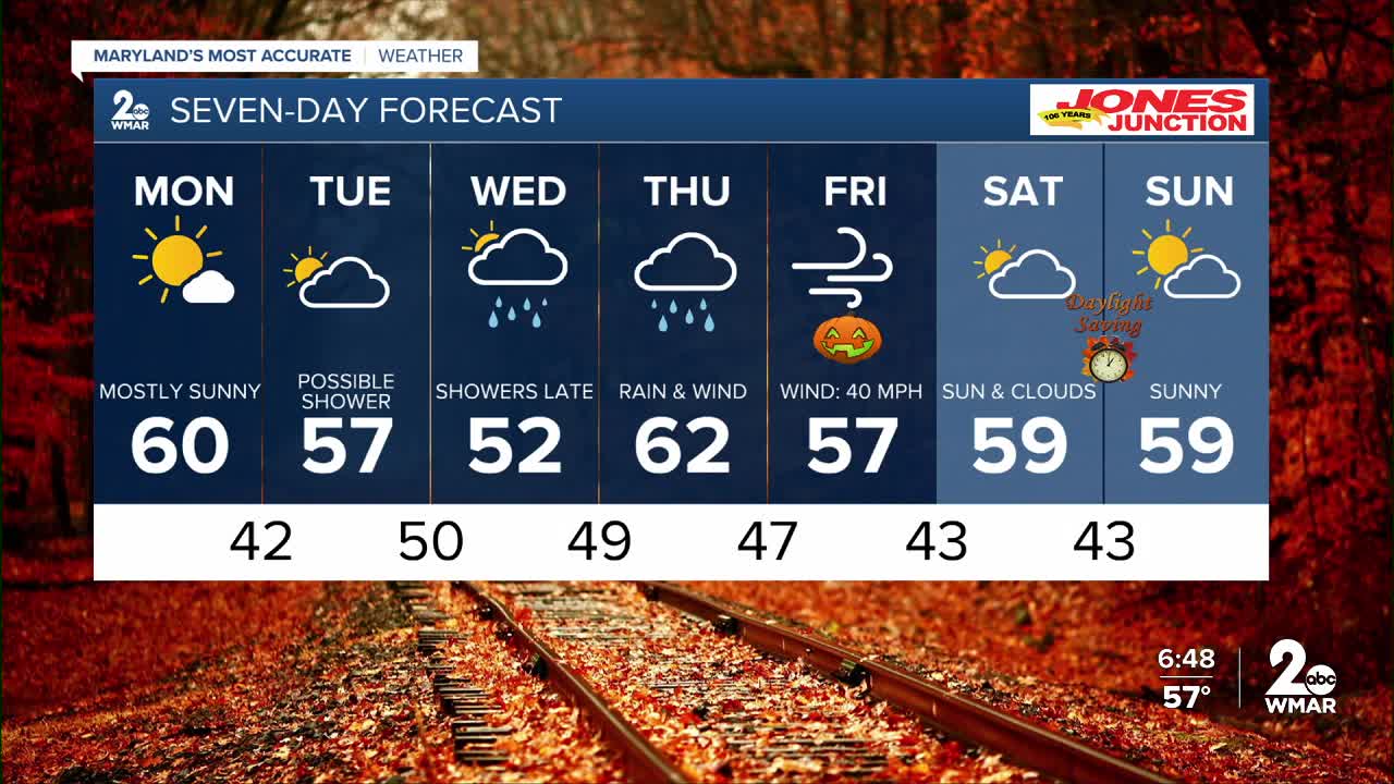
Lets start with the short term: Your Monday weather will be a continuation of the great weather we've seen the past week! Sunshine and temps in the upper 50s to lower 60s.
We are tracking a strong upper-level system that will form across the Tennessee Valley sometime Wednesday, and slide into our region by Thursday. This storm system promises to bring periods of heavy rainfall (more than an inch in some spots), and winds up to 40s mph!
The rain exits the region on Friday leaving us with a dry Halloween, but gusty winds will last through Friday night!

Monday
Sunny, with a high near 59. Northeast wind 5 to 7 mph.
Monday Night
Partly cloudy, with a low around 42. Northeast wind around 6 mph.
Tuesday
A slight chance of showers after 2pm. Partly sunny, with a high near 57. Northeast wind 8 to 13 mph, with gusts as high as 21 mph. Chance of precipitation is 20%.
Tuesday Night
A slight chance of showers. Mostly cloudy, with a low around 43. Northeast wind 6 to 8 mph. Chance of precipitation is 20%.
Wednesday
A chance of showers, mainly after 2pm. Partly sunny, with a high near 59. Chance of precipitation is 30%.
Wednesday Night
Showers likely, mainly after 2am. Mostly cloudy, with a low around 47. Chance of precipitation is 60%.
Thursday
Showers likely. Mostly cloudy, with a high near 57. Chance of precipitation is 70%.
Friday
A chance of showers. Partly sunny, with a high near 57. Chance of precipitation is 30%.
Friday Night
Partly cloudy, with a low around 43.
Saturday
Mostly sunny, with a high near 58.
Sunday
Mostly sunny, with a high near 58.

