


BALTIMORE — TGIF everyone!
Today will be one of the hottest days of the year! Heat Advisories are in place for the area through 8 PM for the entire area. High temperatures will rise into the upper-90s with heat indices up to 109°. Isolated strong to severe storms are possible this afternoon and into the early evening as a cold front approaches. The main concern will be damaging wind gusts. Rain and storm chances linger throughout the weekend, possibly bringing periods of heavy rain and gusty winds. Temperatures will rise into the low-90s on Saturday and Sunday with heat index values around the century mark. The heatwave continues into the middle of next week!
Stay safe
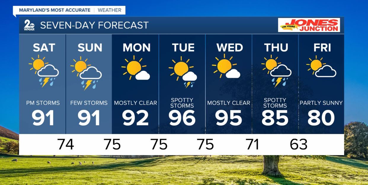
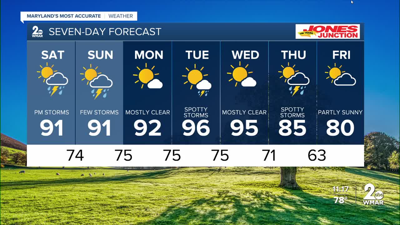
7 Day Forecast:
Today Sunny and hot, with a high near 98. Heat index values as high as 109. West wind 5-10 mph.
Tonight Partly cloudy, with a low around 77. West wind around 5-10 mph.
Saturday A chance of showers and thunderstorms. Partly sunny, with a high near 91.
Saturday Night A chance of showers and thunderstorms. Mostly cloudy, with a low around 74.
Sunday Showers and thunderstorms likely. Mostly cloudy, with a high near 91.
Sunday Night Showers and thunderstorms likely. Mostly cloudy, with a low around 75.
Monday Mostly sunny, with a high near 92.
Monday Night Mostly clear, with a low around 75.
Tuesday Mostly sunny, with a high near 96.
Tuesday Night Partly cloudy, with a low around 75.
Wednesday Sunny, with a high near 95.
Wednesday Night Partly cloudy, with a low around 71.
Thursday A chance of showers. Partly sunny, with a high near 85.
Thursday Night A chance of showers and thunderstorms. Mostly cloudy, with a low around 63.
Friday A chance of showers. Partly sunny, with a high near 80.

