


BALTIMORE — Good Thursday evening!
Much needed rainfall occurred earlier today, with many receiving beneficial rainfall!
We dry things out after 9pm Thursday night, with sunny skies anticipated on Friday. There is still a slight chance of a sprinkle Friday, but the vast majority of you stay dry.
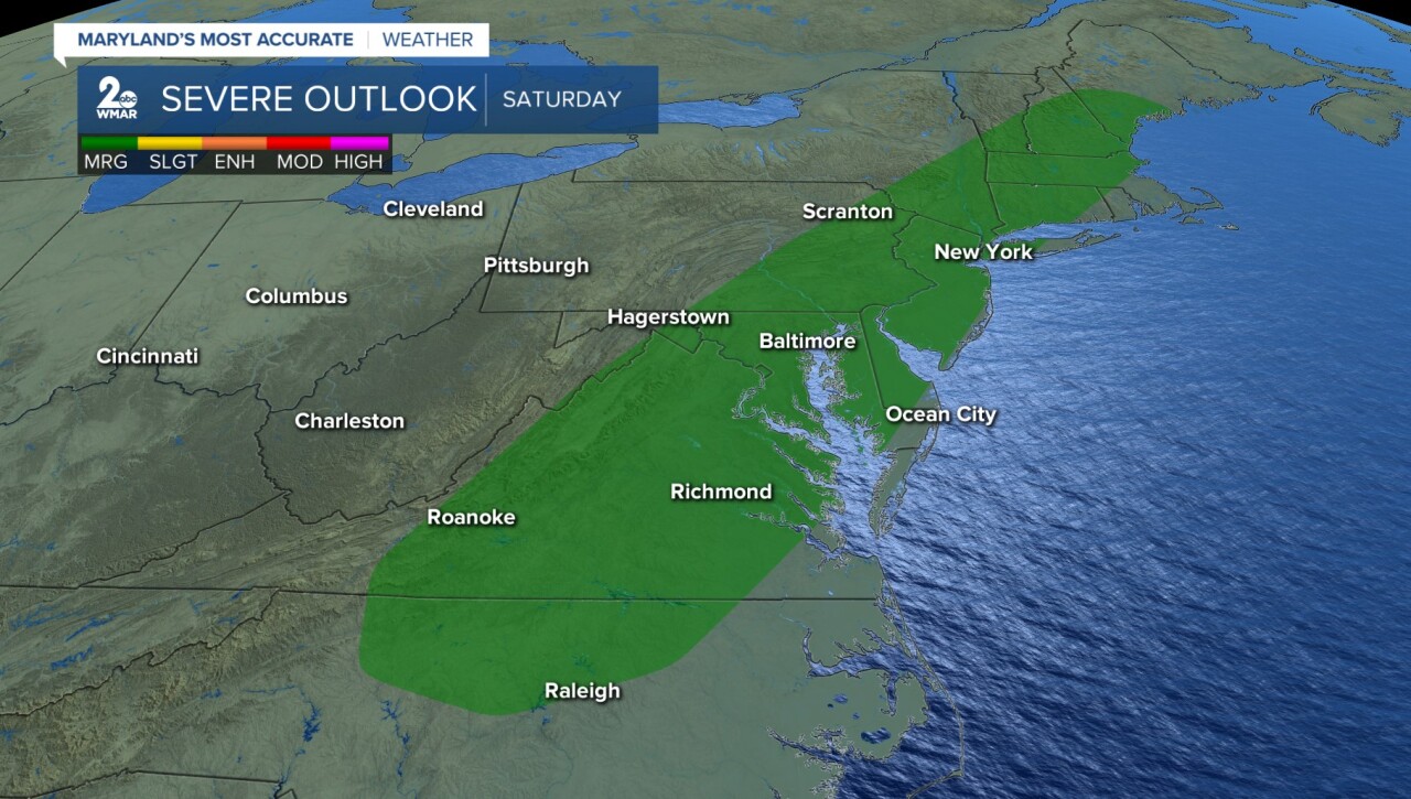
Our attention quickly turns to another fast moving robust cold front Saturday. All the ingredients are present in the atmosphere to promote severe storms. As of now, our severe risk is low (1/5), however, some storms may contain hail and damaging wind. The timing will be similar to today, with storms between 3-9 pm. If you have outdoor plans on Saturday you will need a way to get weather alerts.


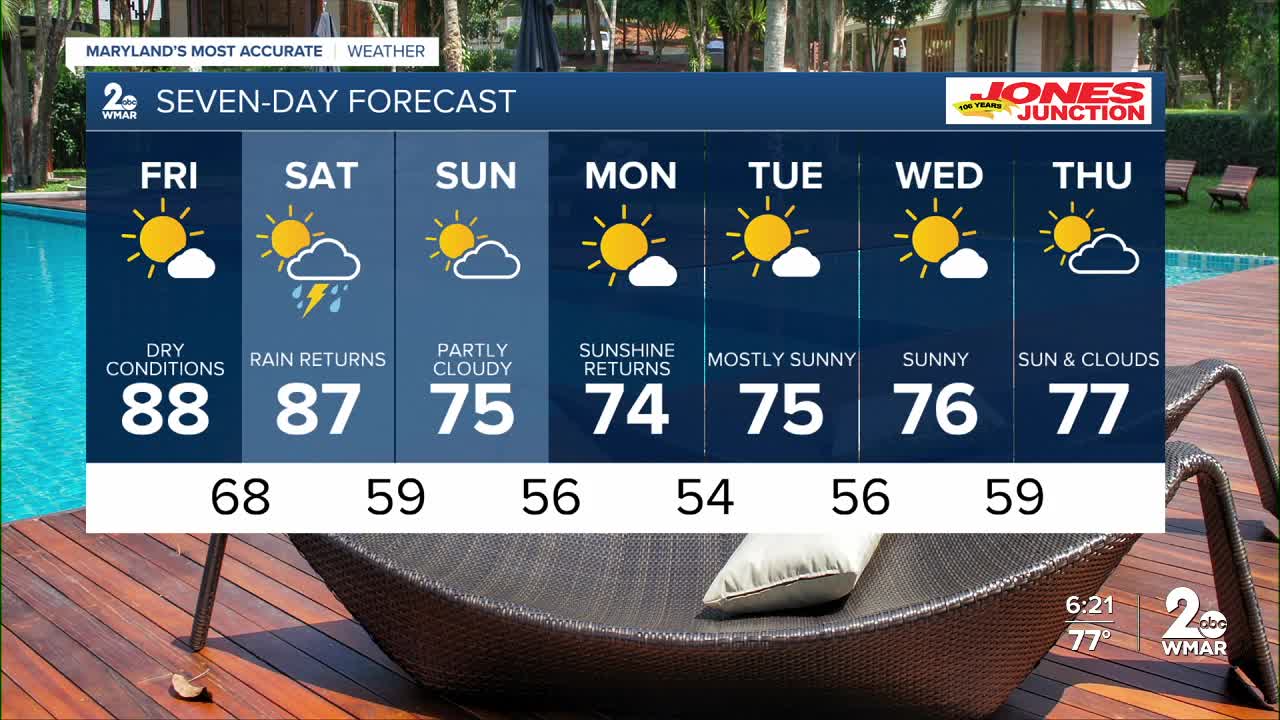
7 Day Forecast:
Friday Mostly sunny, with a high near 88.
Friday Night Mostly clear, with a low around 68.
Saturday Showers likely and possibly a thunderstorm. Mostly sunny, with a high near 87.
Saturday Night Showers likely and possibly a thunderstorm. Cloudy, with a low around 59.
Sunday Partly cloudy, with a high near 75.
Sunday Night Partly cloudy, with a low around 56.
Monday Sunny, with a high near 74.
Monday Night Mostly clear, with a low around 54.
Tuesday Sunny, with a high near 75.
Tuesday Night Partly cloudy, with a low around 56.
Wednesday Mostly sunny, with a high near 76.
Wednesday Night Partly cloudy, with a low around 59.
Thursday Mostly sunny, with a high near 77.

