


BALTIMORE — Good Wednesday evening!
A cold front swung through the region earlier today, and behind it cold air will settle into the region tonight. Clear skies and calm winds will allow temps to drop to the lower 40s! Western Maryland has a Freeze Watch until 9AM Friday as temps drop to the 30s!
Sunshine is expected Thursday through Saturday before our next system arrives Sunday night.
The majority of Sunday will be dry, but showers breakout Sunday night and wrap up by Monday morning!
Stay warm!
Dylan

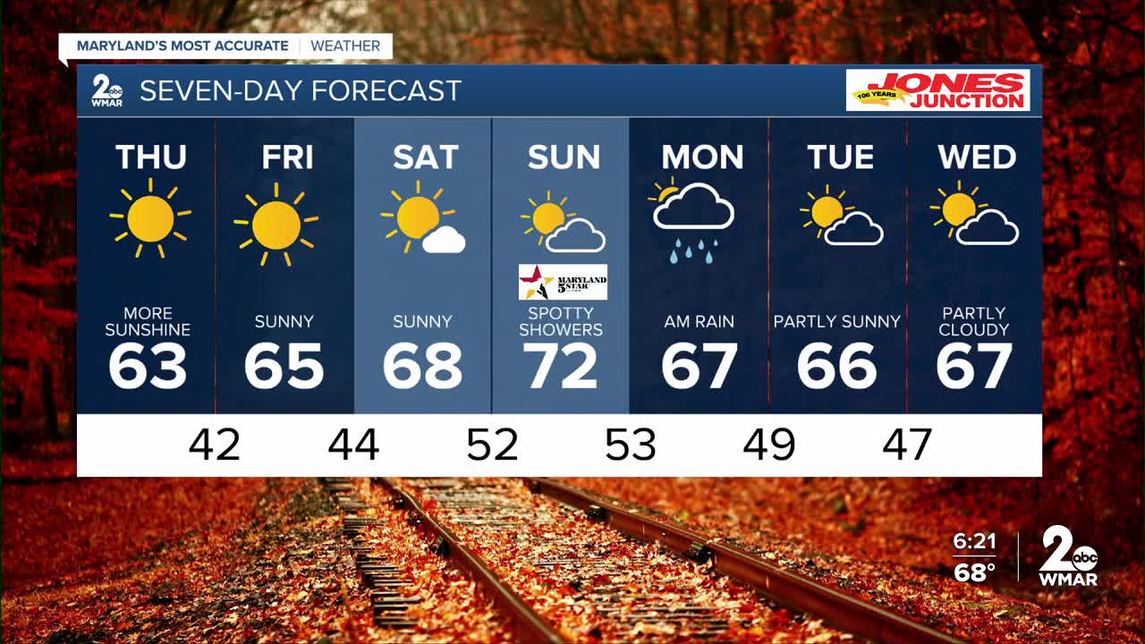
7 Day Forecast:
Thursday Sunny, with a high near 63.
Thursday Night Clear, with a low around 42.
Friday Sunny, with a high near 65.
Friday Night Mostly clear, with a low around 44.
Saturday Mostly sunny, with a high near 68.
Saturday Night Partly cloudy, with a low around 52.
Sunday A chance of showers. Partly sunny, with a high near 72.
Sunday Night Showers likely. Mostly cloudy, with a low around 53.
Monday A chance of showers. Partly sunny, with a high near 67.
Monday Night Partly cloudy, with a low around 49.
Tuesday Partly cloudy, with a high near 66.
Tuesday Night Partly cloudy, with a low around 47.
Wednesday Partly cloudy, with a high near 67.

